Botswana Game reserves, Friday 14- Sunday 16 July 2023

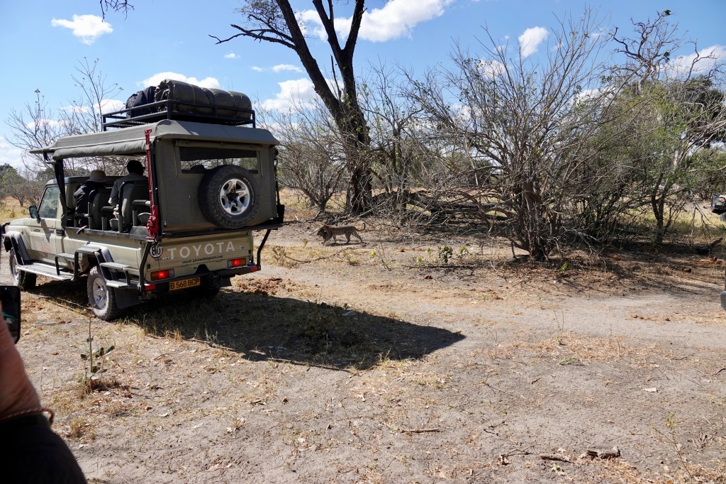
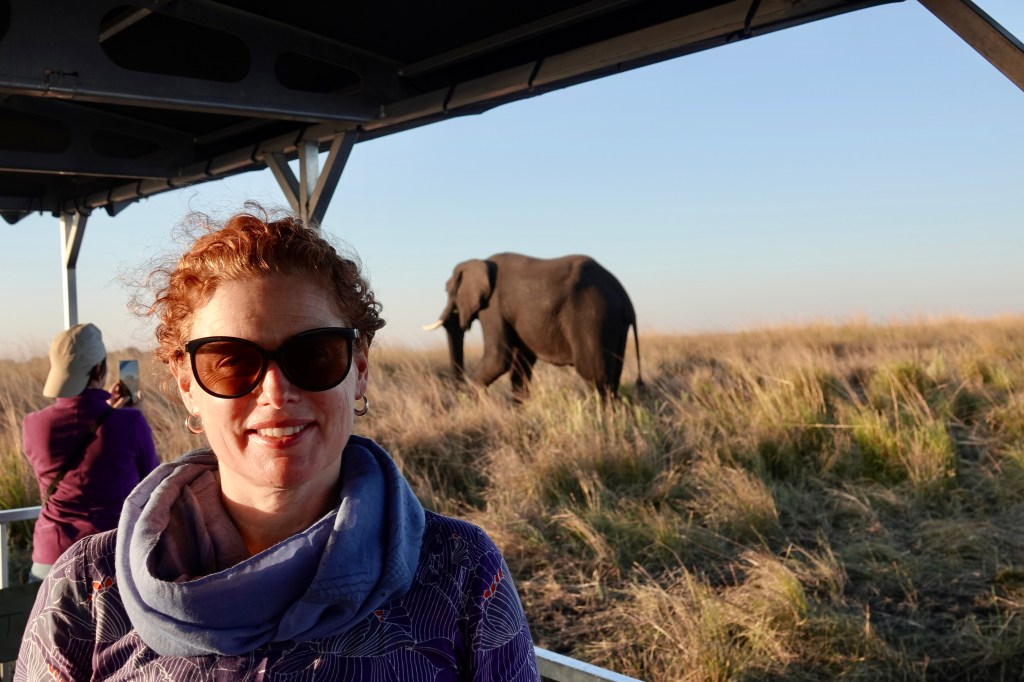
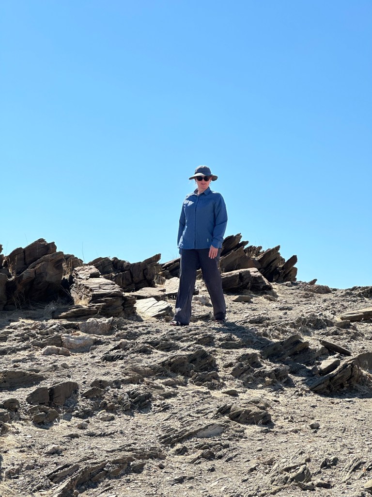
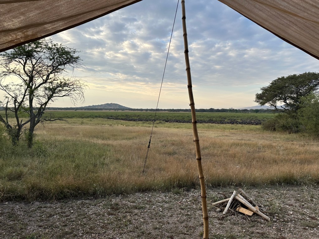
Friday morning saw us up at 0500 for an early breakfast before heading out on a game drive in the Khwai conservation area. We were pretty much wearing every warm piece of clothing we had as the morning was very cold and the vehicle movement added considerable wind chill.

More stripey horses – these ones being Plains Zebra like we saw in Tanzania, unlike the Burchell’s Zebra which were predominant in Namibia

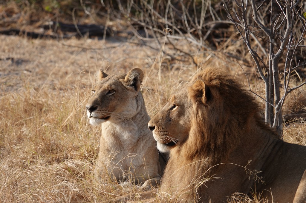
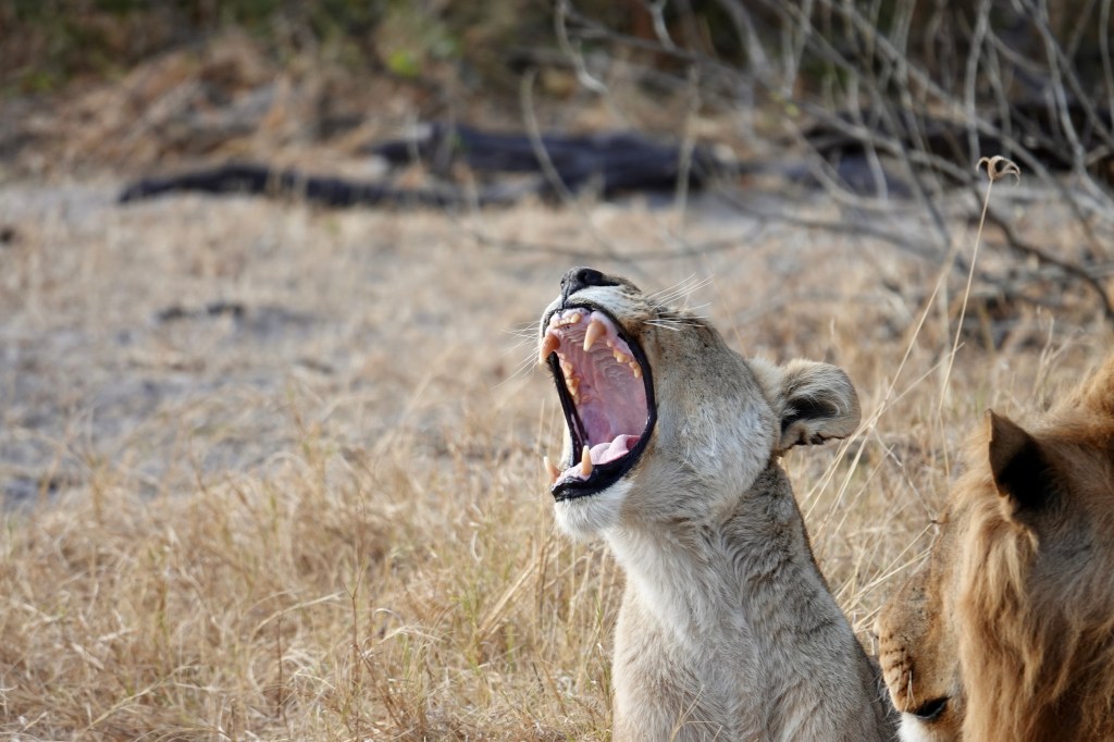
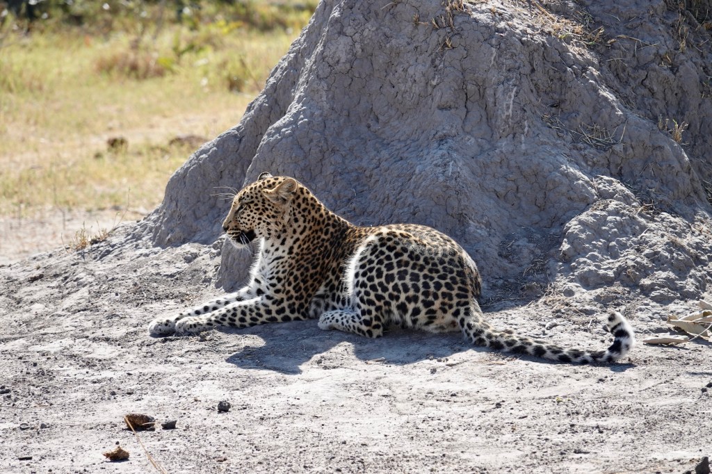
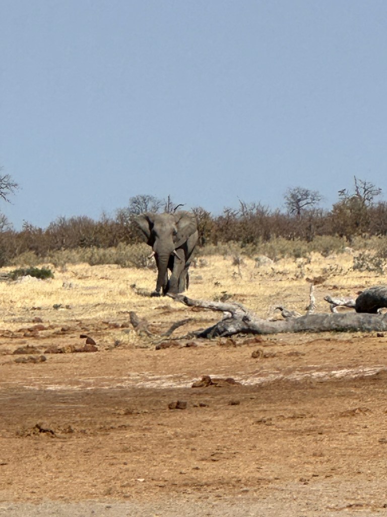
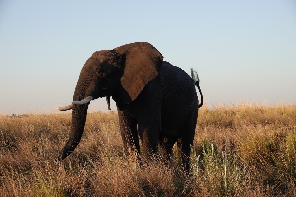
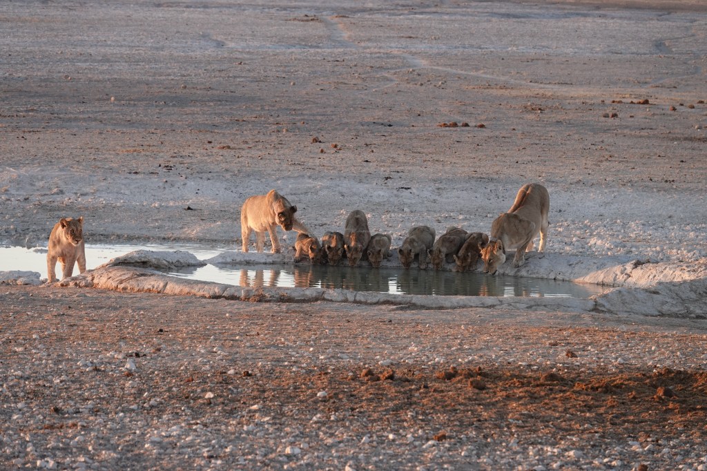
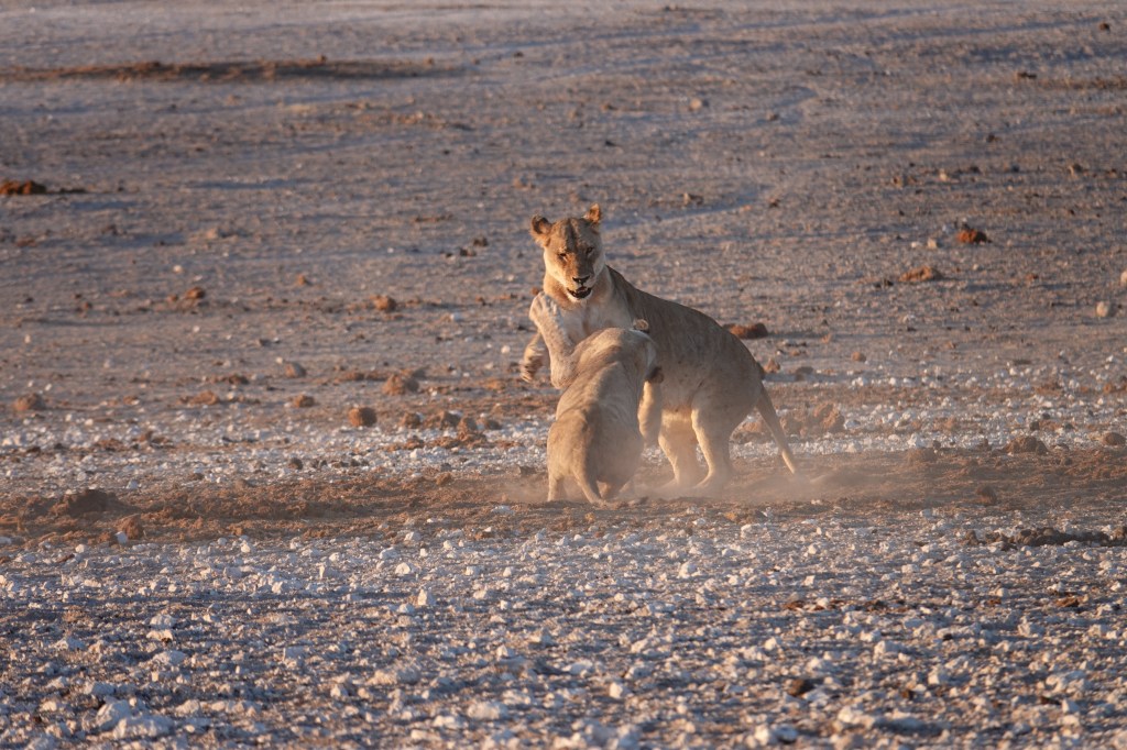
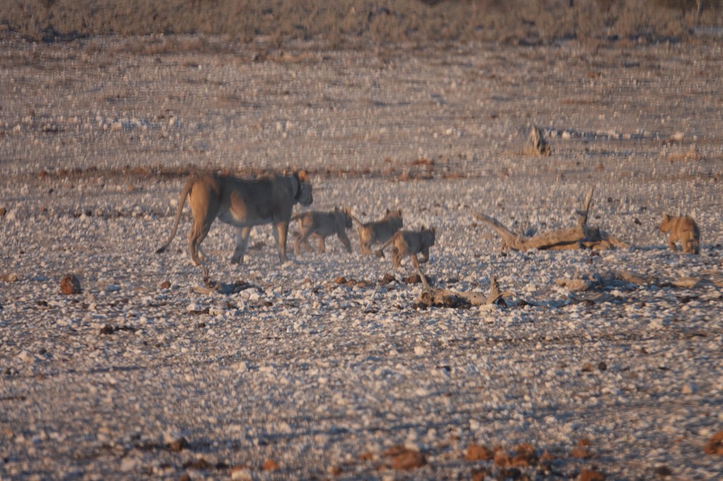
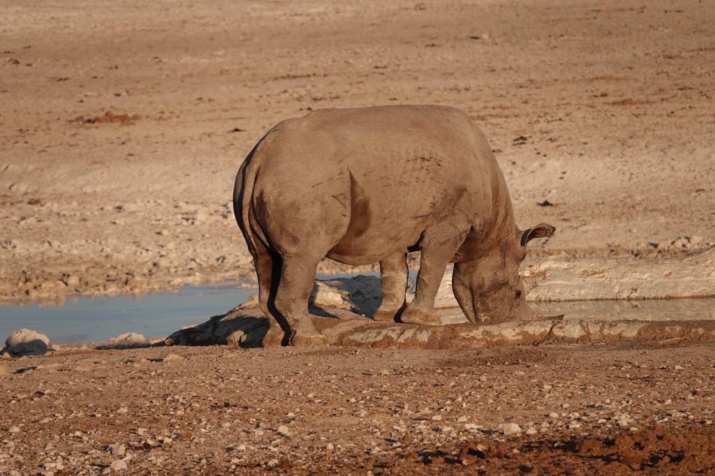
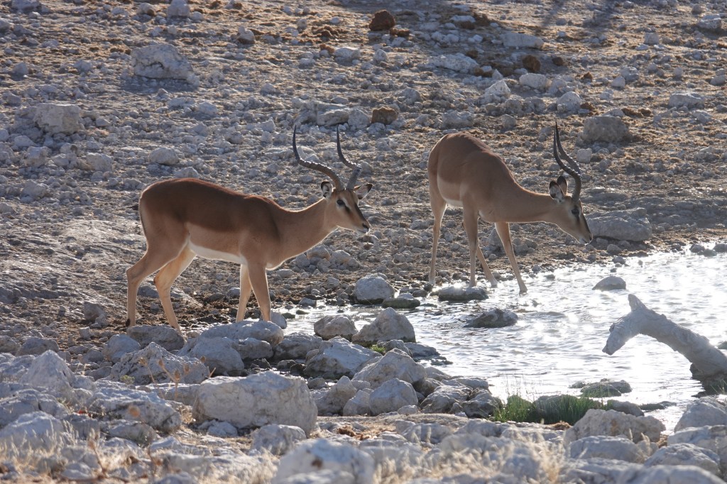
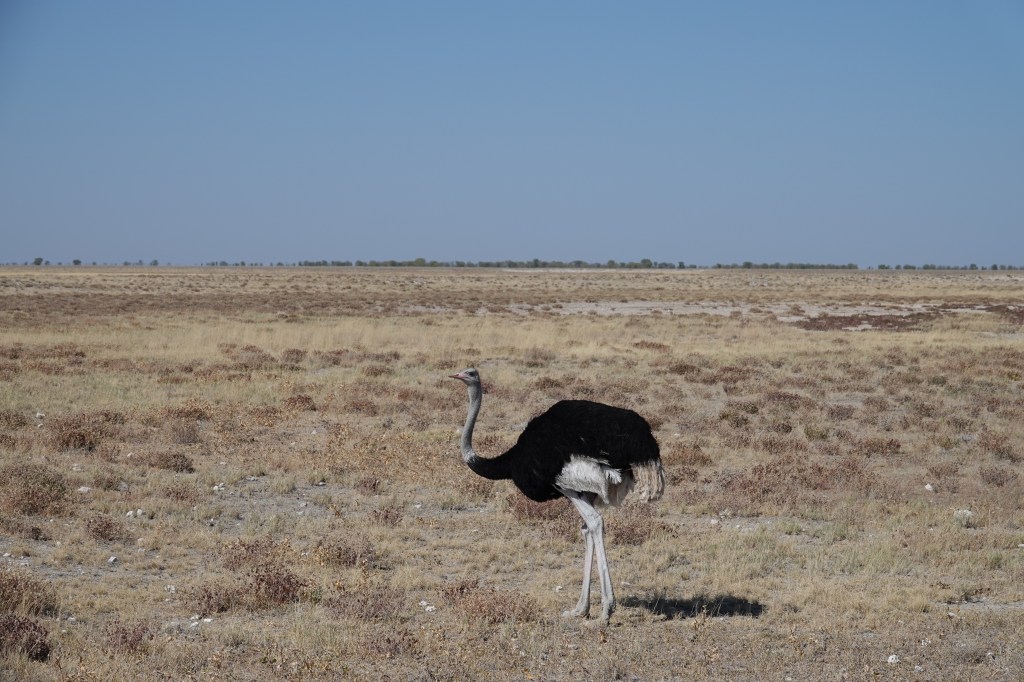
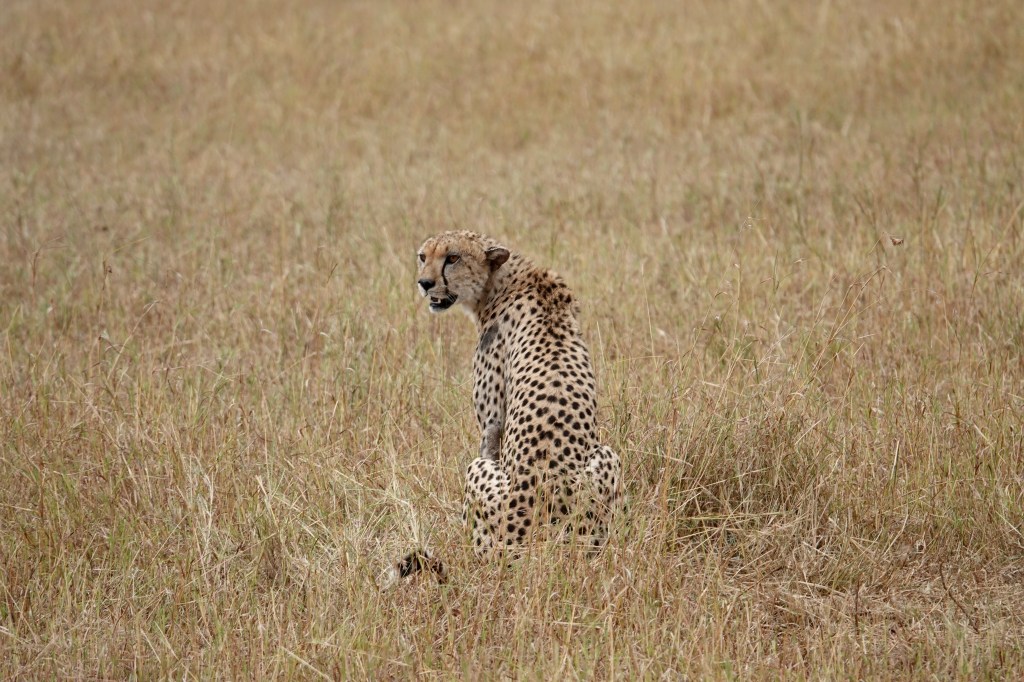
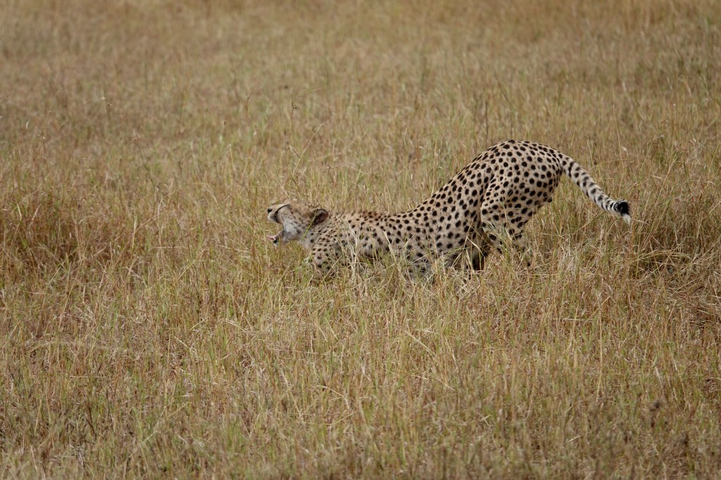
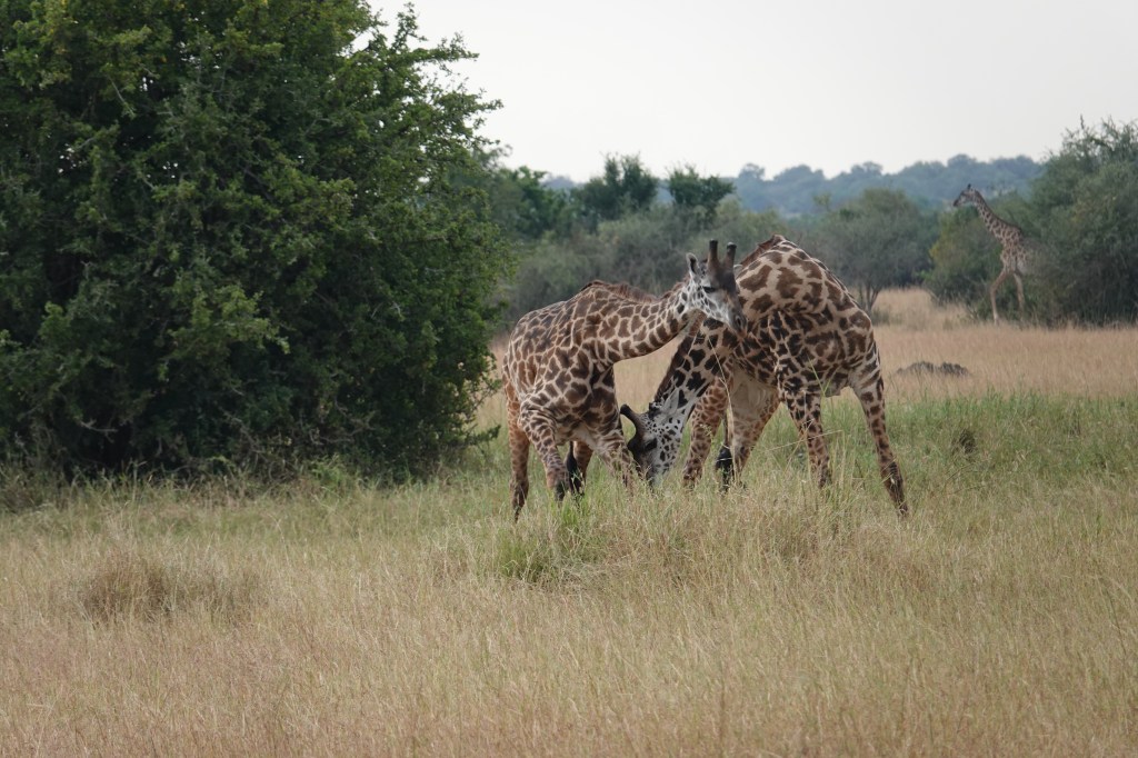
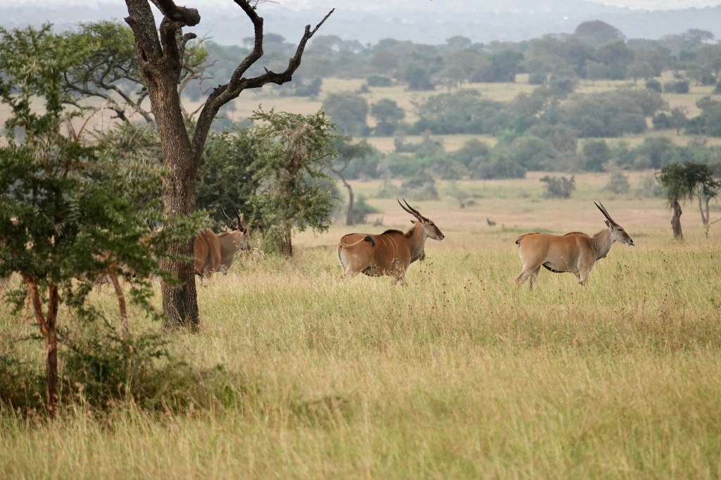
The temperature was quickly forgotten as we had sone high quality game spotting. Two separate, great leopard spottings, a couple of lions seeking peace , quiet and privacy for a breeding session (they were sorely disappointed) and numerous elephants and birds.

Frustrated lovers
Bored with the attention
Wattled Cranes – apparently increasingly rare- not sure why.
Look closely into the bush and you can see the leopard eating the bum out of an impala she had just killed and dragged in there
Grooming herself after her meal
Stretching out

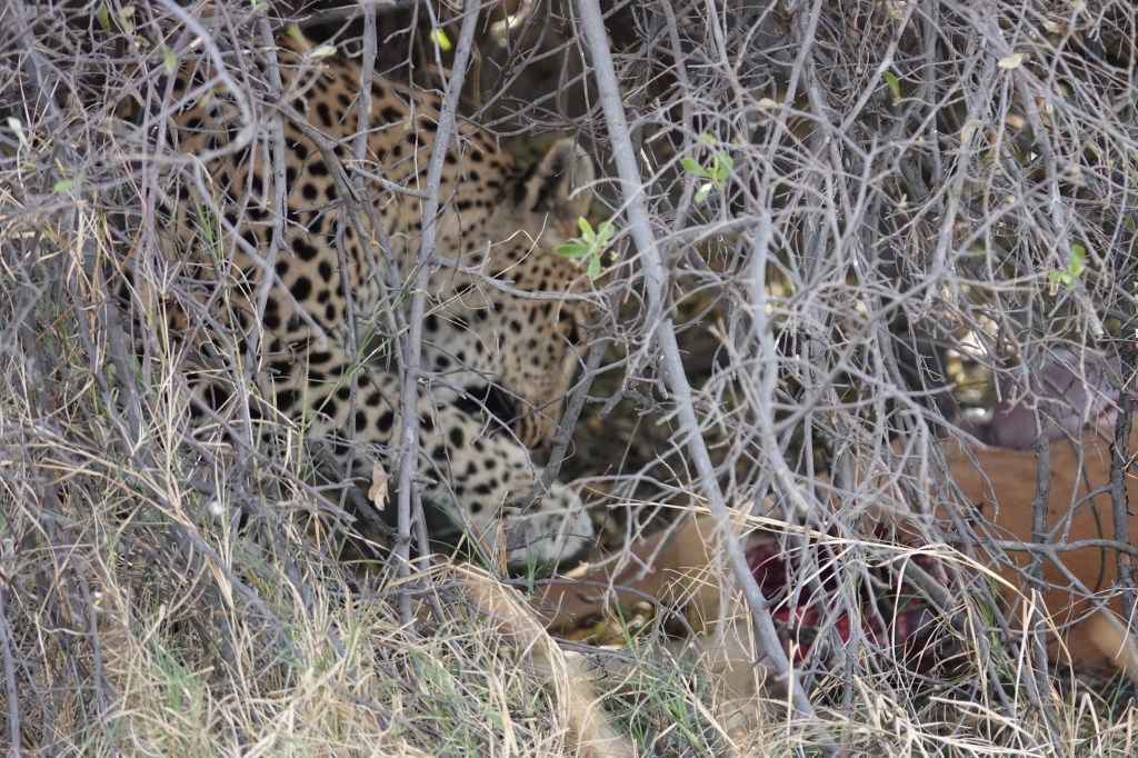
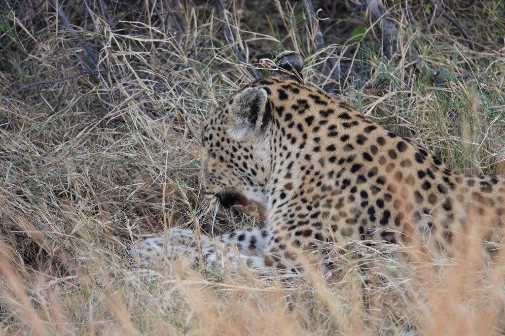
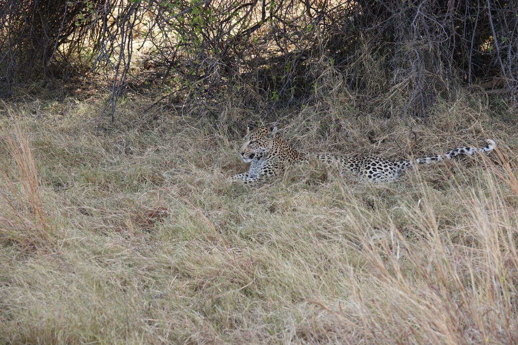
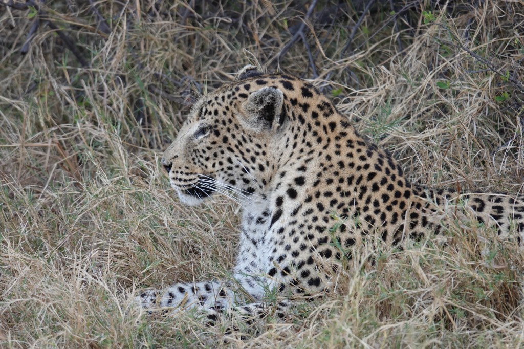
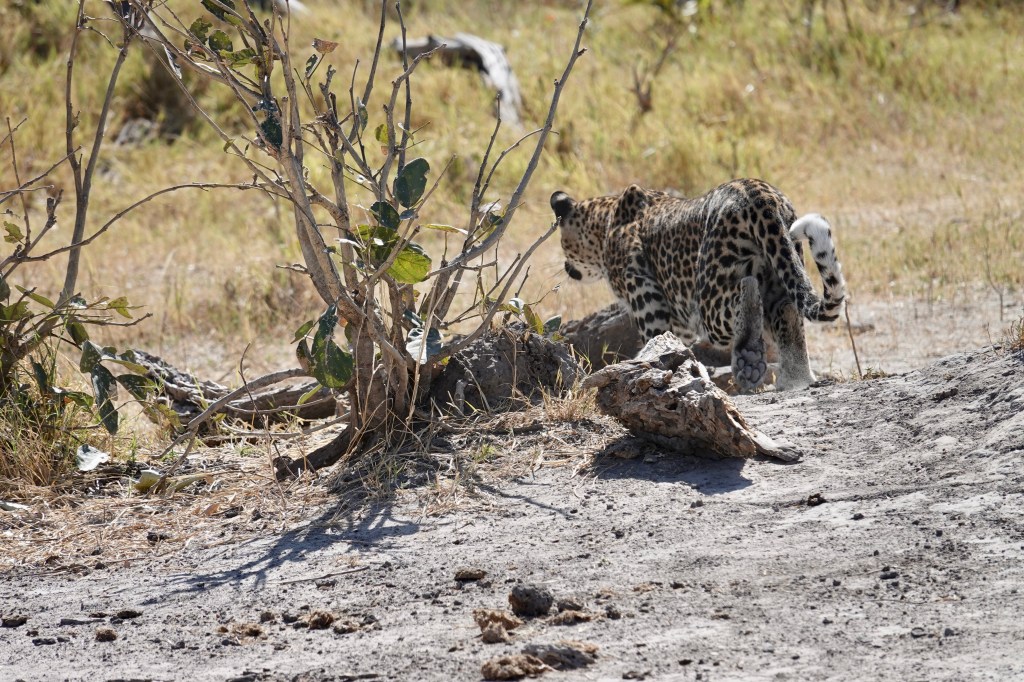
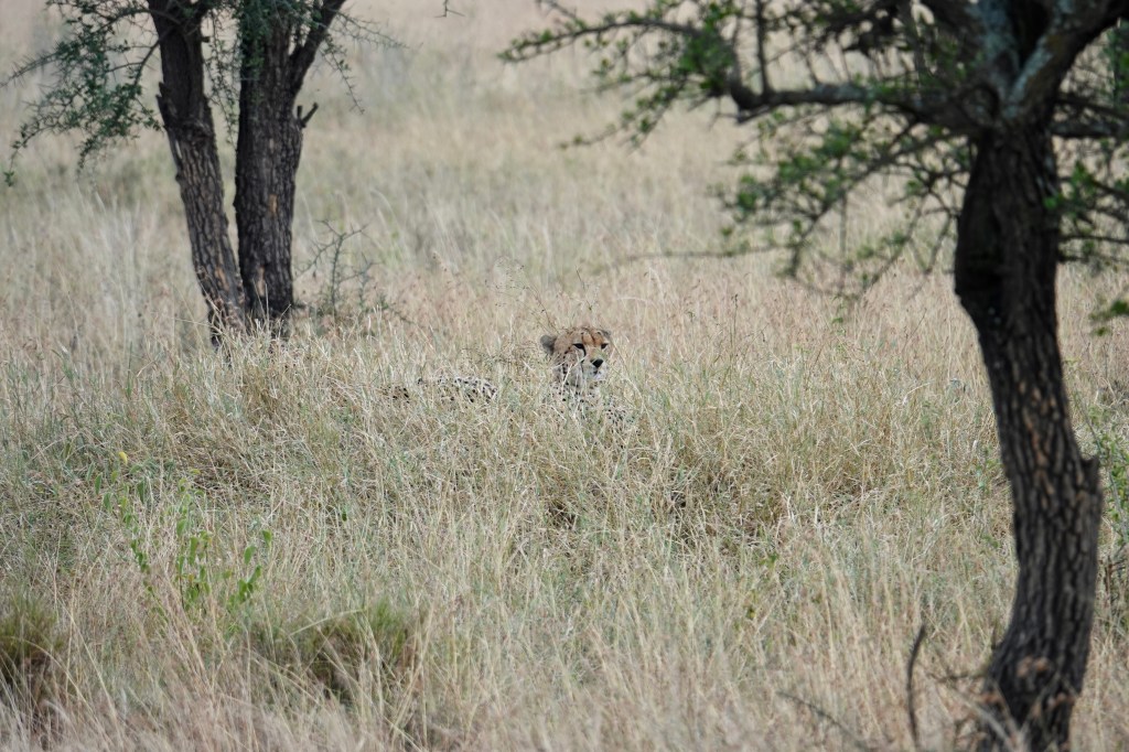
The first leopard was a female who had just killed an impala doe. She had dragged it into a bush, ate a bit, cleaned herself up and then layout for a stretch and snooze.

Contemplating something

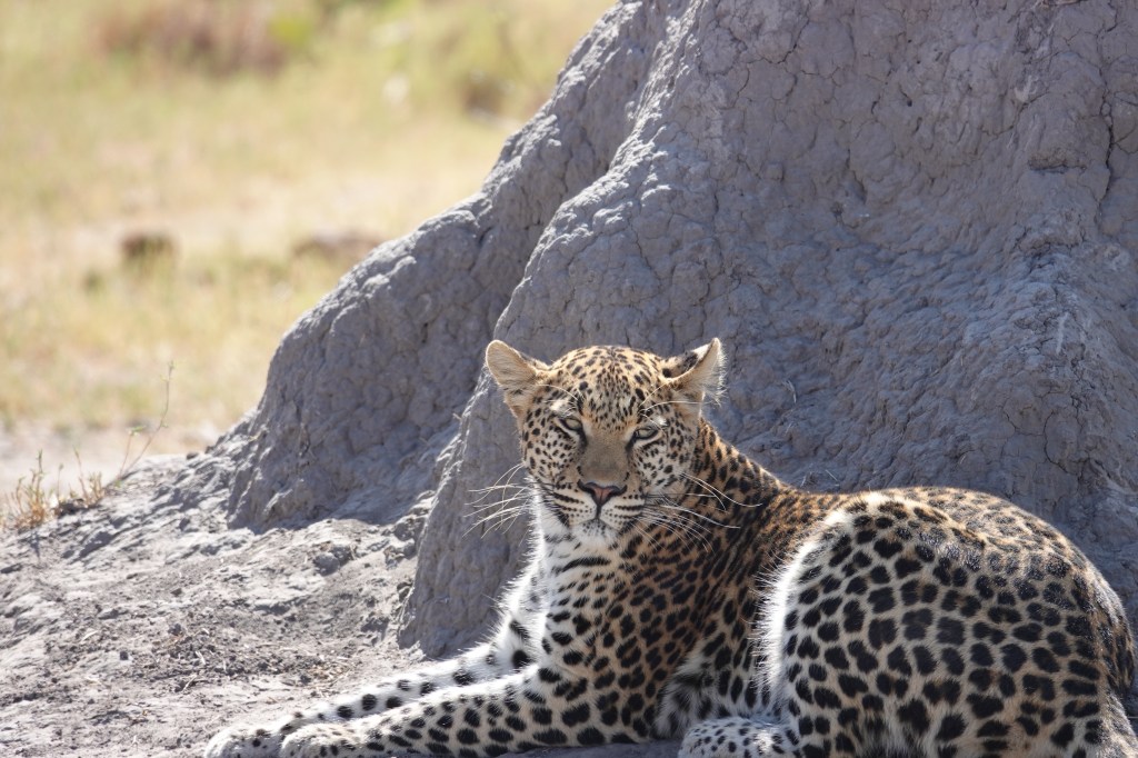
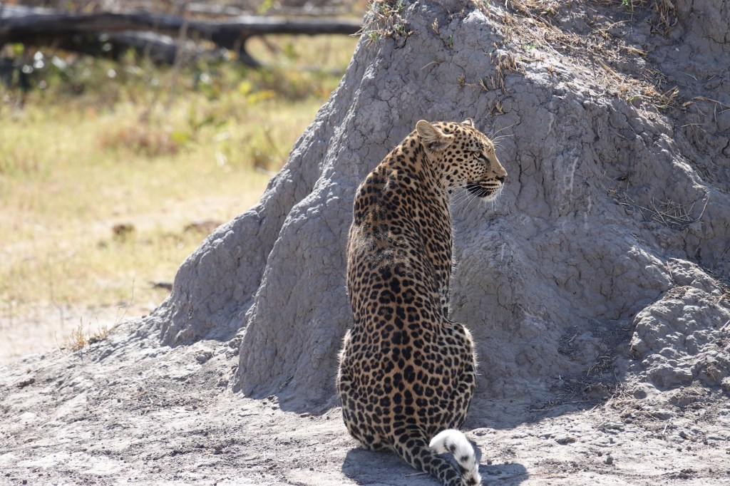
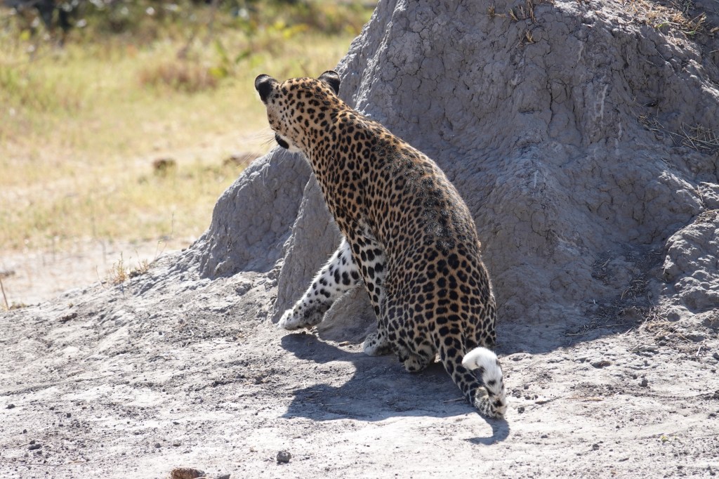
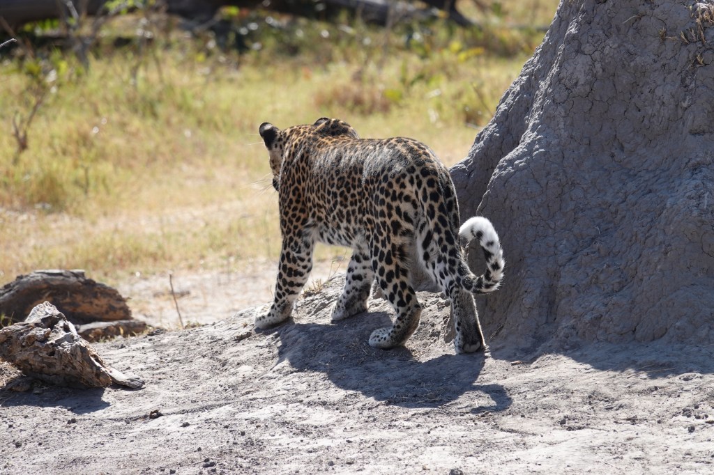
We think the second leopard was a male. We found him about an hour later, after seeing more elephants.

Elephants drink a hell of a lot of water
African Jacana ( the so-called ‘Jesus Bird’ because it seemingly walks on water)

He hung out behind a termite mound for a bit, then stalked and killed a Guinea fowl for a snack as we watched. We didn’t get the shot, but he leapt around 1.5 metres into the air and plucked the bird in mid-flight – a spectacular jump. We left him spitting out mouthfuls of feathers.

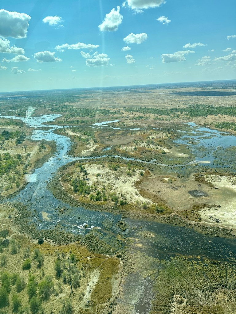
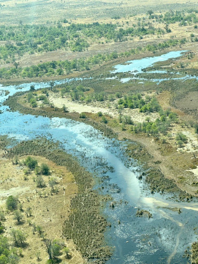
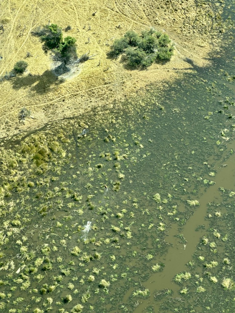
After a brief sojourn back at our camp for lunch we went down one of the main branches of the delta channels in a traditional canoe known as a Mokoro. The difference from the old days is that they are now made from fibreglass, they previous practice of using 200 year old plus trees ultimately proving unsustainable in the delta.

On the mokoros in the delta

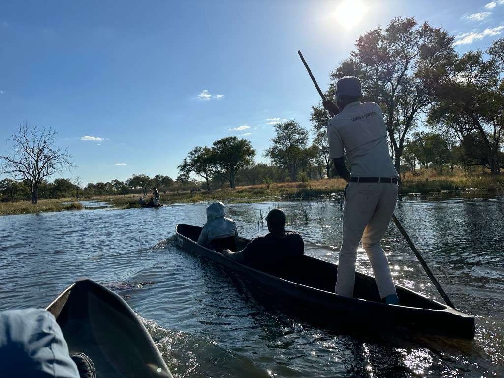
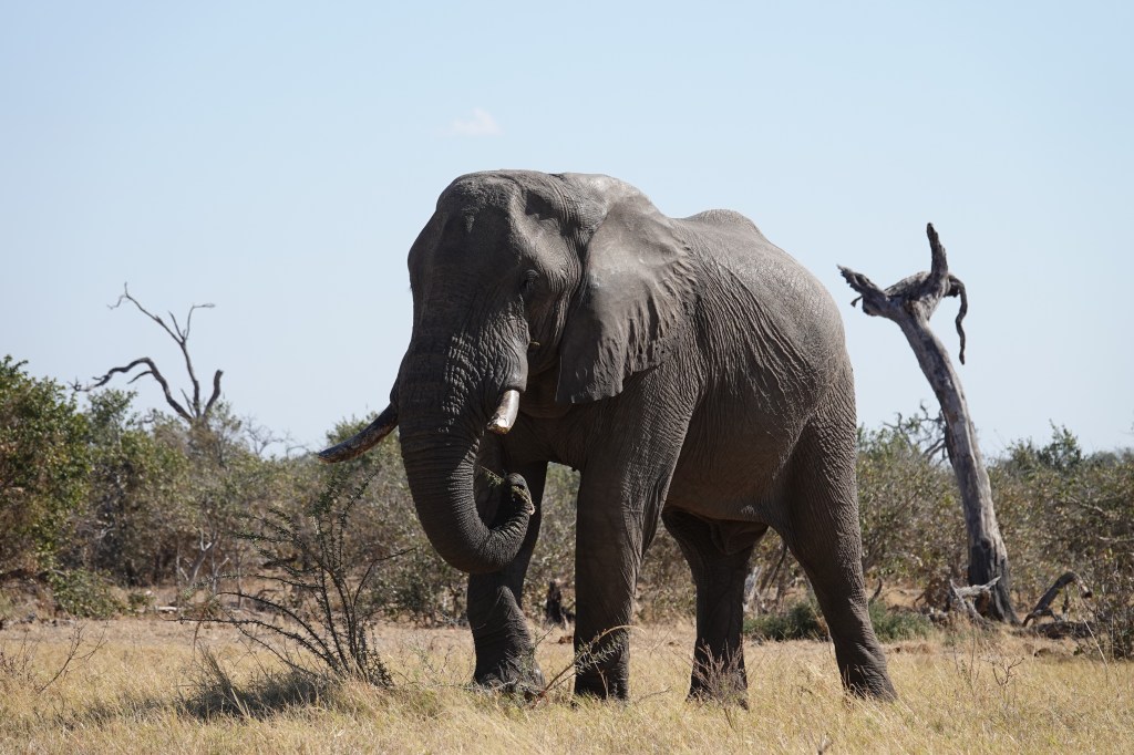
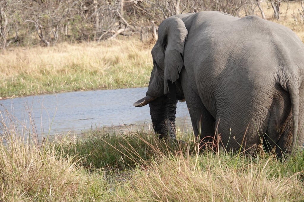
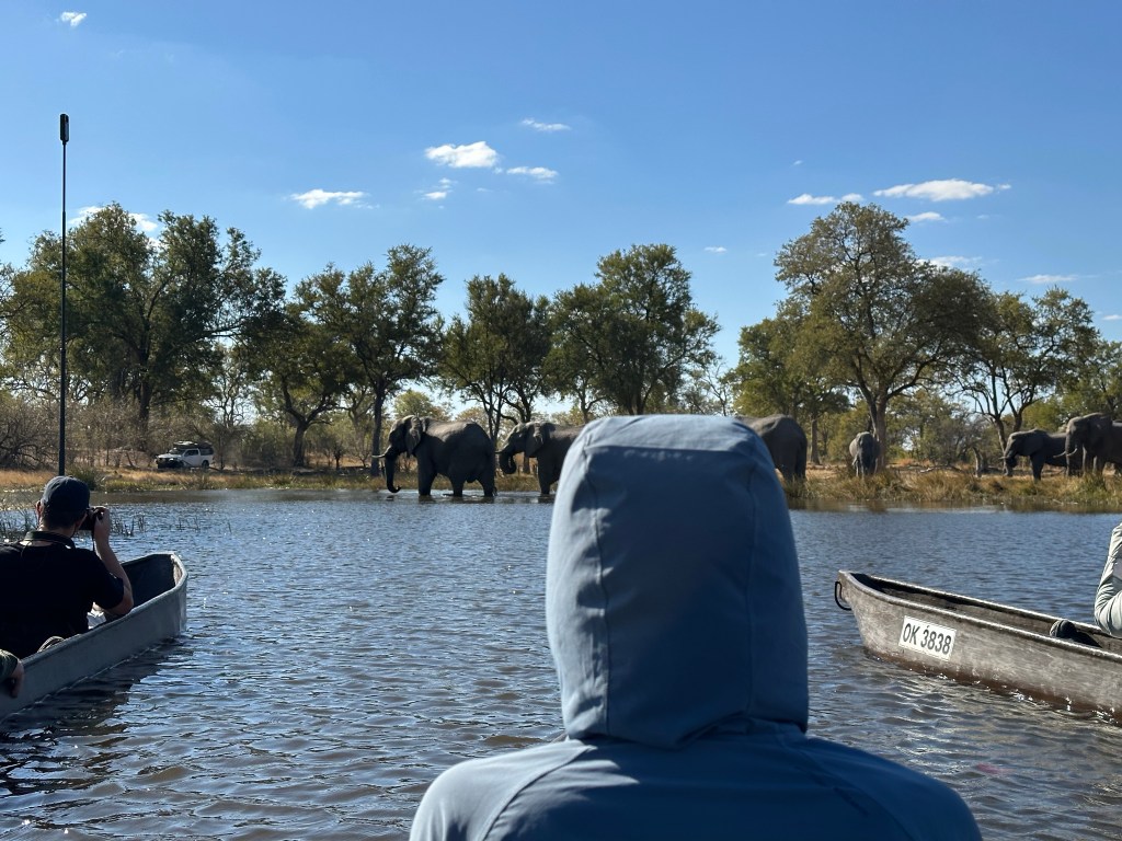
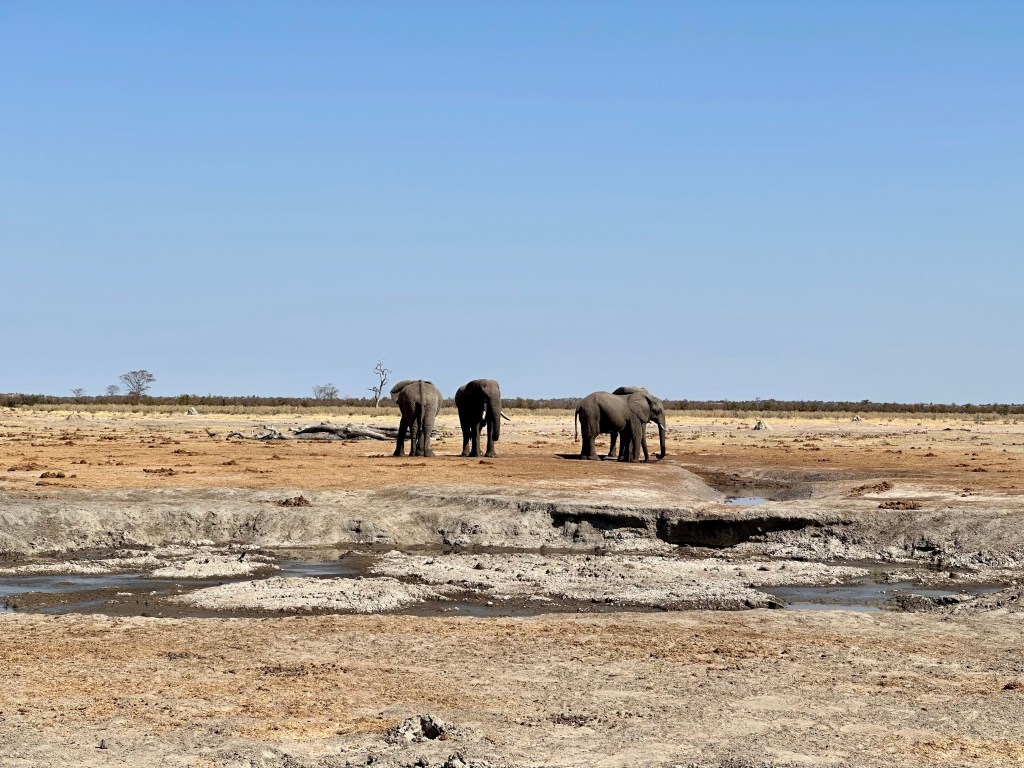
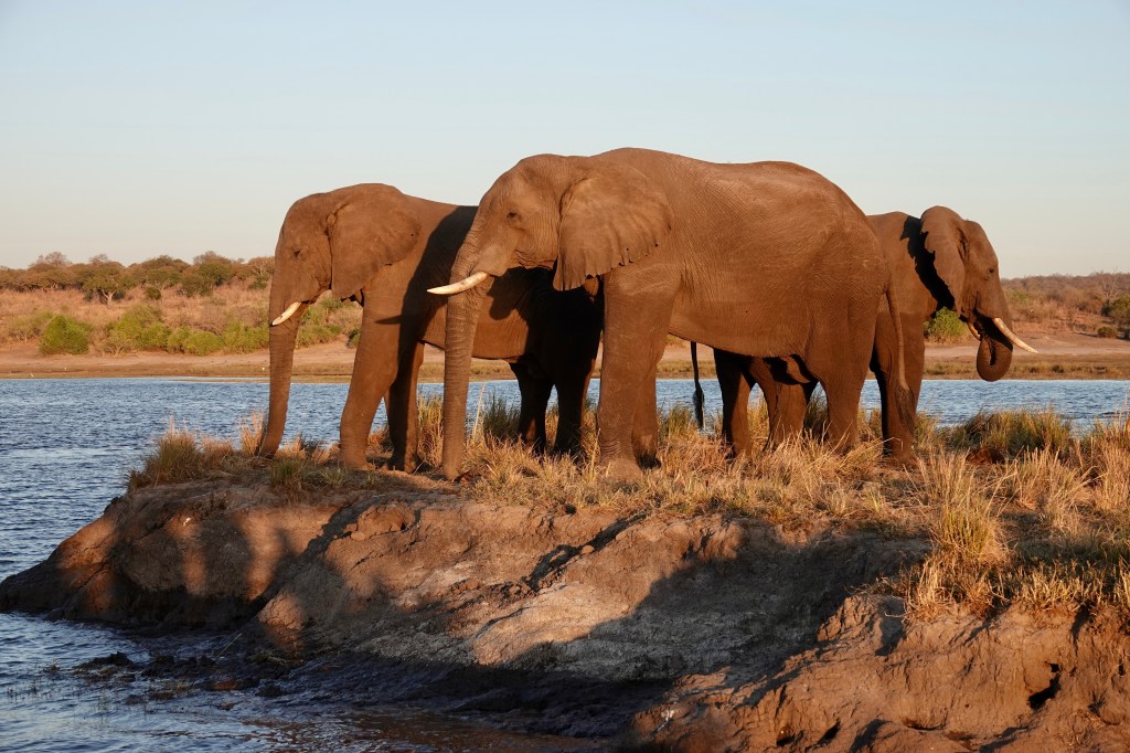
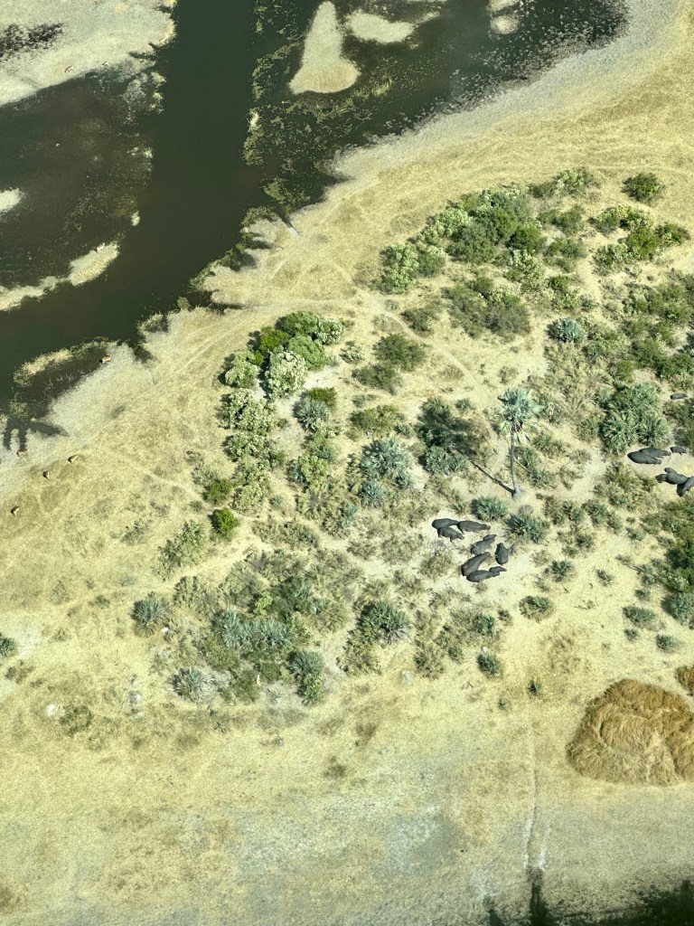
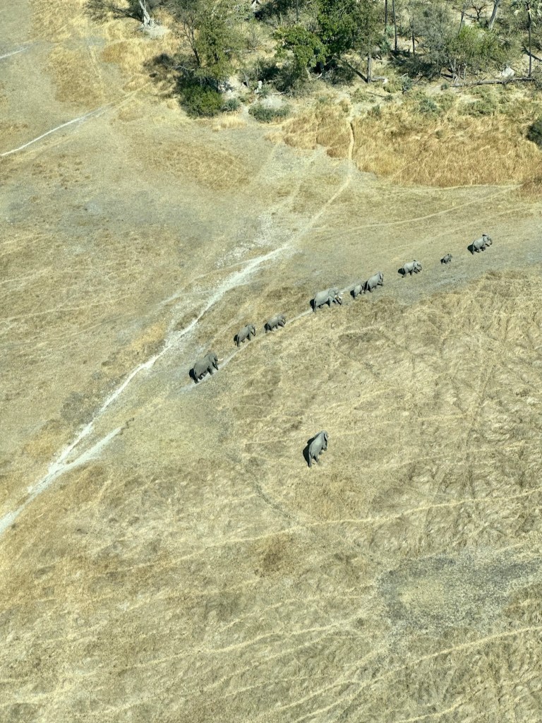
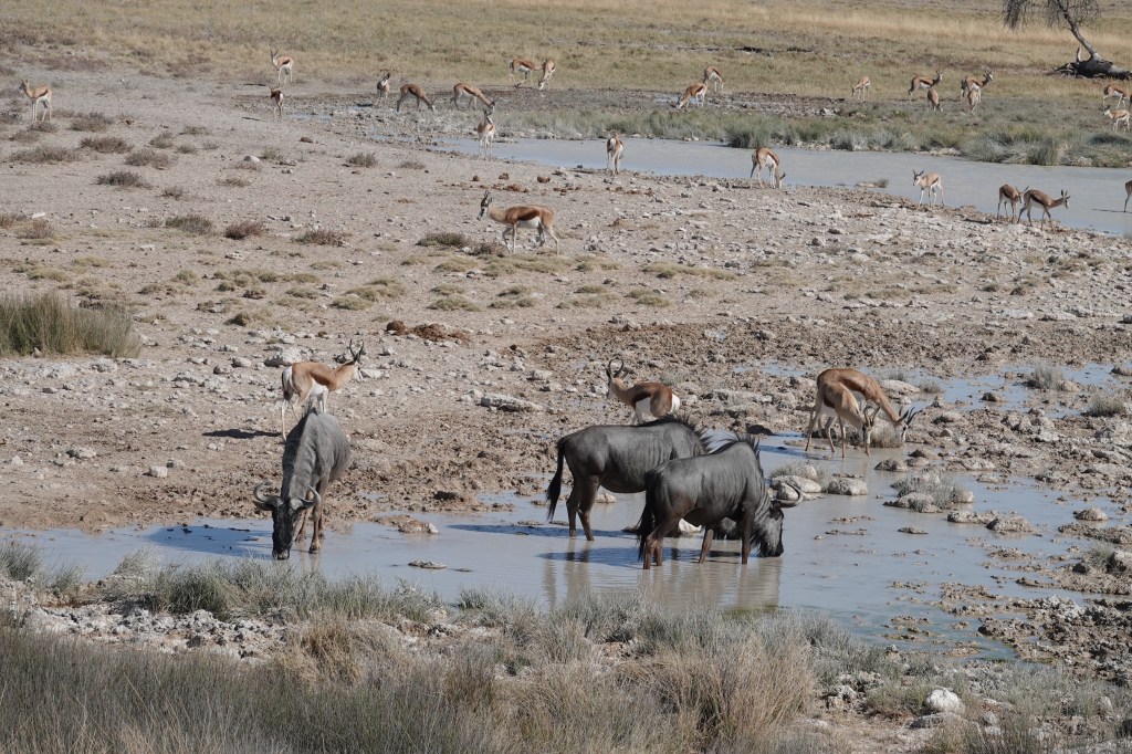
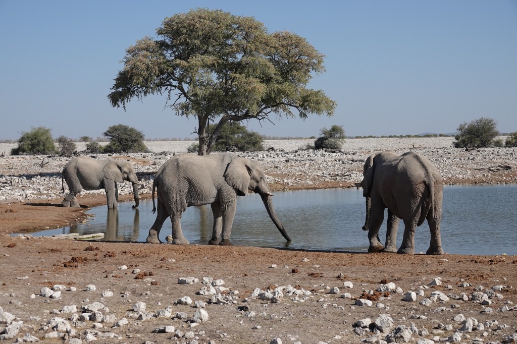
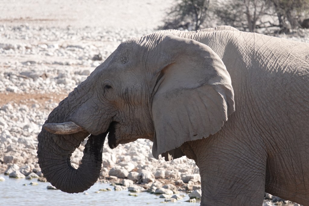
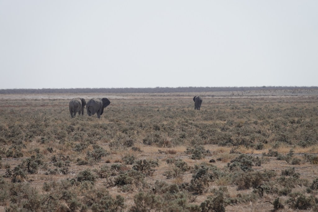
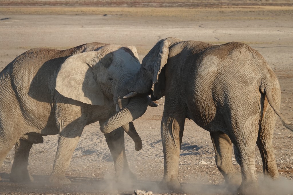
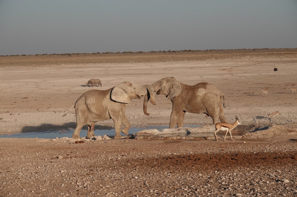
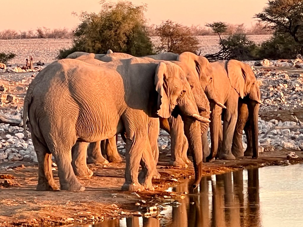
A massive highlight of being in the Mokoros was the ability to get very close ( almost uncomfortably close) to game. On this afternoon we literally ended up on a breeding herd of over 30 elephants taking on their afternoon drinking water.

Some of the herd of elephants seen from our mokoro

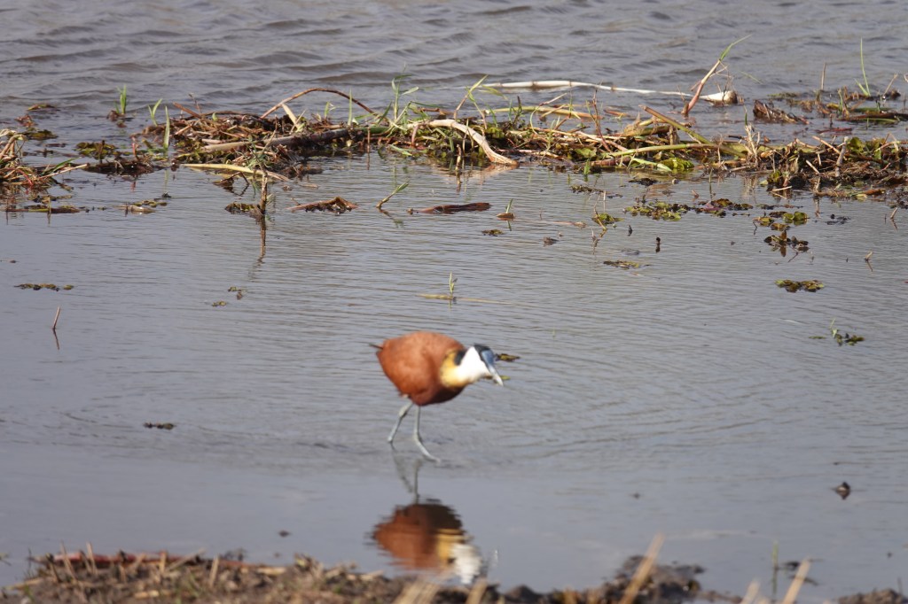
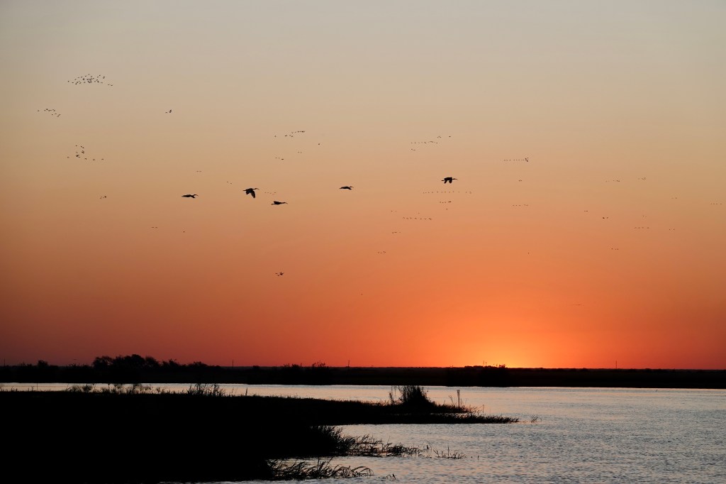
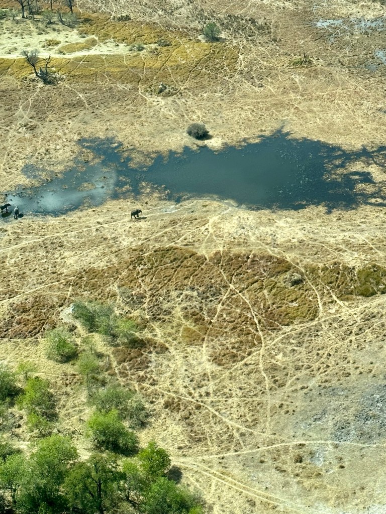
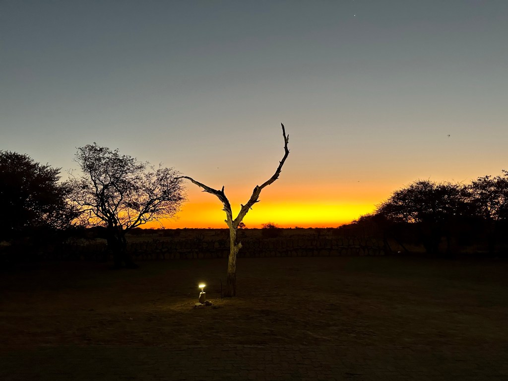
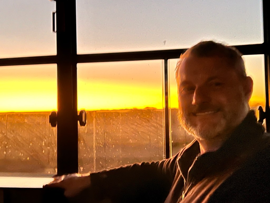
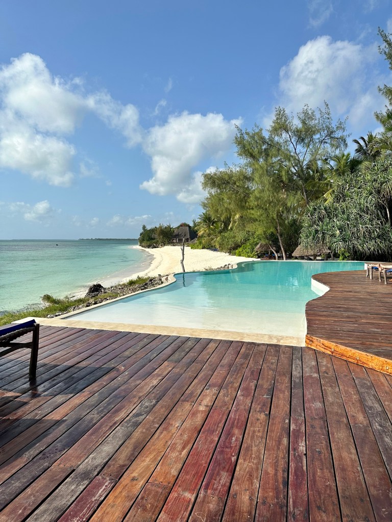
After the mokoro adventure our guide found us a waterhole with hippos and crocs. We watched the sunset over the waterhole with G&Ts or Talisker. A great end to an another beautiful day out bush. Good leopard sittings are quite rare- two like we had in one were exceptional and we were more than happy with the great game viewing we had. Back to the camp for dinner and fire pit story time before another snug night under the quilt in our tent.

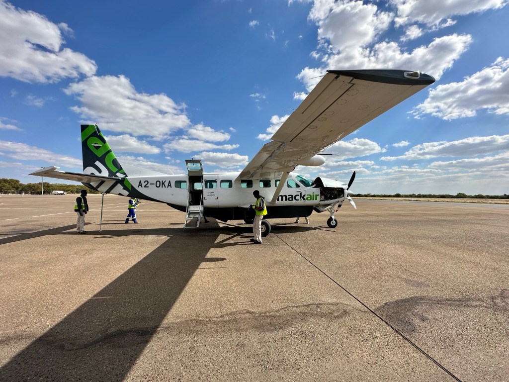
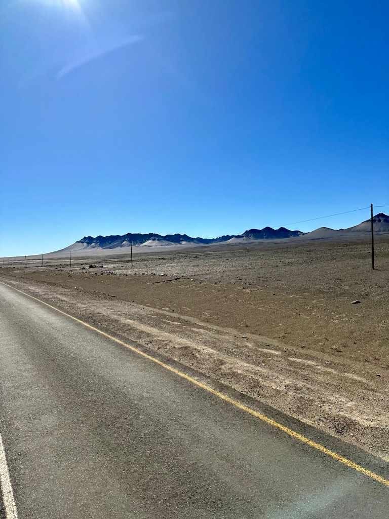
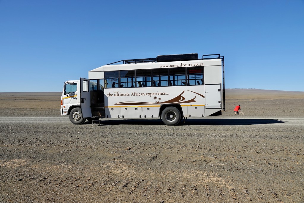
We were up very early on Saturday morning the 15th July. There are two ways to drive to Kasane from the Khwai conservation area. Back to Maun and a nearly 650km journey from their on the highway, or directly through the Khwai, Savute, Linyati and Chobe parks / conservation areas on very crappy roads. We did the latter, a distance of just over 200km that took us 11 1/2 four wheel driving ours – with ever changing scenery and game thrown in. We even got to refresh our tyre changing skills about halfway through – certainly easier with a few people helping!

Elephants in the Savute
Another Savute elephant

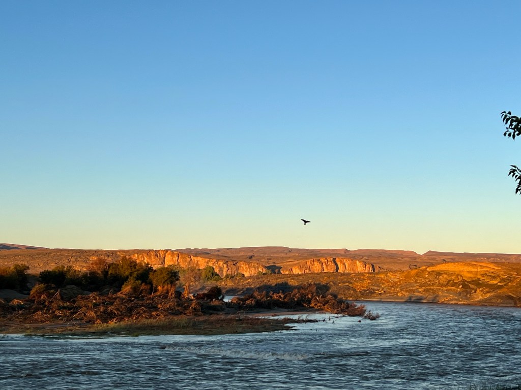
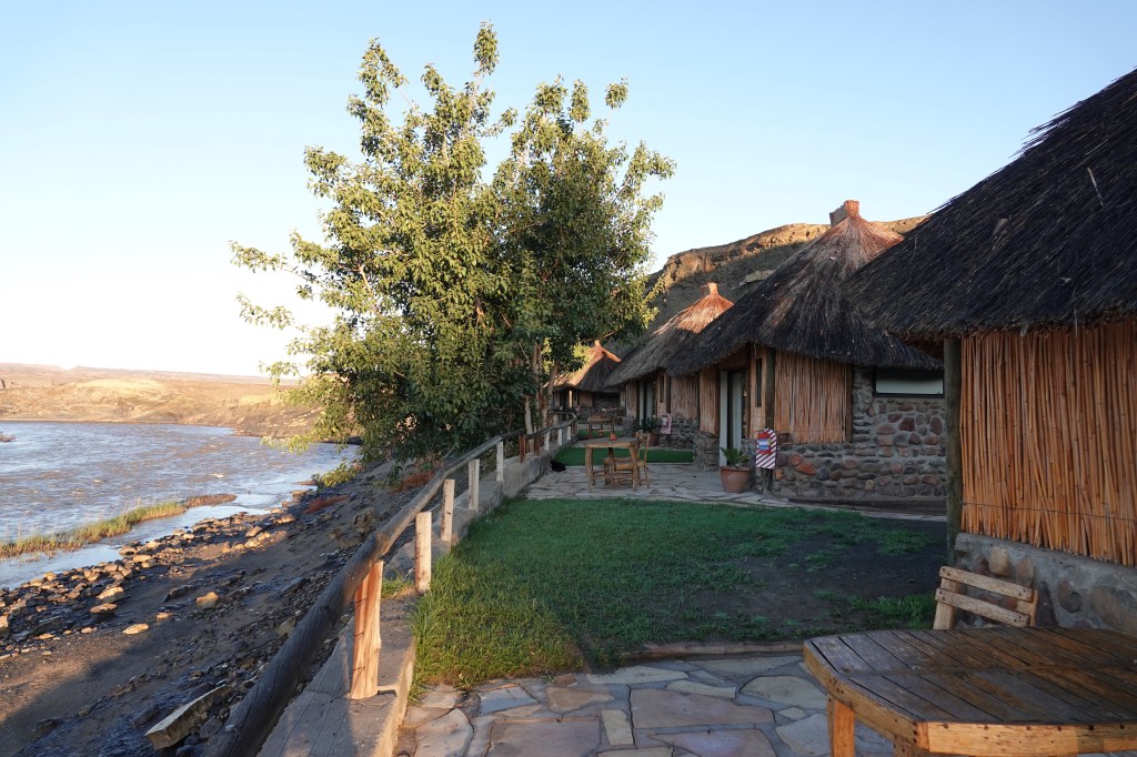
We arrived in Kasane ( on the Chobe River, near the intersection of Botswana with Namibia ( the Caprivi Strip), Zambia and Zimbabwe at 1730. We were all a bit shattered after 11 1/2 hours exposure to the elements and corrugations in an open game vehicle. It wasn’t long after dinner before everyone did the AJ fade away and hit the rack.

On Saturday morning the 16th most of the group opted for a sleep in after a week of 5am starts our earlier. Our two Americans, Mel and Matt braved an early morning game drive in the Chobe Park and were rewarded with sone sightings they had been chasing.

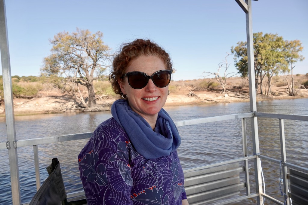
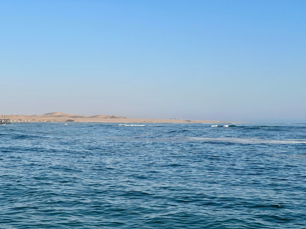
In the afternoon we took a sunset cruise on the Chobe River, which at this point marks the border between Botswana and Namibia. We actually had to provide the tour boat operator with our passport details in case we ended up at in Namibia again at some point .

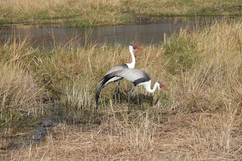
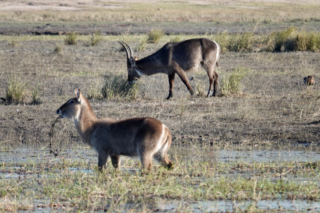
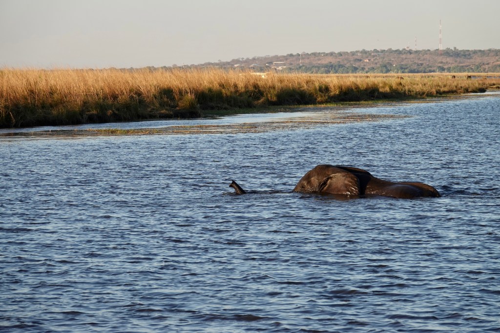
The river cruise was great. Apart from the sunset, highlights were the bird life, water buck, stacks of hippos and elephants swimming the river to get to an island in the middle for sweeter pastures,.

Chobe River sunset cruise
Water Buck
Bull elephant swimming across the Chobe River to the Namibian side
Sunset on the Chobe looking back at the Caprivi Strip

After the cruise it was back for dinner on our last night in Botswana- and the novelty of watching the Wimbledon men’s final at an early hour.

Into Botswana- and the Okavango Delta, 12-13 July

Wednesday morning the 12th was a cold morning in Windhoek. The day was spent in transit to Botswana- it was a long day with the strong easterly still blowing , the head wind making the truck’s progress even slower.

Our Cessna Caravan for the Delta flight

A highlight of an otherwise‘slow’ day was entering the Kalahari Desert. While much larger than the Namib Desert, it has a lot more vegetation. The landscape is reminiscent of parts of the Northern Territory- although very, very flat.

Mark excited because he had the front seat and could ‘help the pilot’😉🤣🤭🙄 Kevin, Warren and Matt behind

After an uneventful border crossing it was a couple more hours until we arrived at our lodge just outside the town of Ghanzi. We also stopped briefly to get Pula from an ATM in town. All in all, a long day.

Thursday AM and another early start. Our destination was Maun ( the ‘Safari Capital’) of Botswana. After a great coffee and cake at the ‘Dusty Donkey’ cafe in Maun ( very good coffee!) we headed to the airport for a scenic flight over the Okavango Delta ( Less Nessie, who has an aversion to low, bumpy flights and the nausea they induce).

Part of the Delta!

The Okavango Delta covers a large area off central west Botswana. It is fed by the Okavango River, which rises to the north in the highlands of Angola. The river delta comprises five major branches and countless minor streams and watercourses. The five major branches contain water permanently, the other areas wax and wane according to seasonal variations and inputs.

Our pilot, Ash

An interesting fact about the Okavango Delta is it is the only river delta in the world that doesn’t end in the sea. It is essentially sucked up and disappears into the sands of the Kalahari Desert.

The ‘blob’ on the island is actually a pod of hippo working on their tan ☀️
The white ‘splotches ‘ just left of centre low are Impala running across a shallow pan
Lone Elephant heading for a drink
Another tanning

After the flight we hopped into an open Toyota Landcruiser Safari vehicle which was to be our mode of transport for the next three days. Five chilly and bouncy hours ( and a very good sighting of a pack of Spotted Hyena later) we were at our lodging for the next two nights. We stayed at the ‘Pride of Africa’ tented camp, situated on a water course on the border between the Moremi and Khwai conservation areas. After a hearty (and warming) dinner, and a few red wines around the fire we were quite tired. We went to sleep to the sounds of lions doing their thing in the marsh at the edge of camp.

Ross on the plane
Video of heading out on the Landcruiser – we were to spend a lot of time in this vehicle as we crossed the wild areas of Botswana over the next three days

We saw a lot of game from the air – it is surprising how much you still see at 450 feet AGL and around 140 knots IAS. A phenomena Mark hadn’t seen before the flight was pods of Hippopotamus lying around sun bathing during the day – they are normally immersed in a body of water during the day. There was were also countless groups of elephants and the ‘usual’ zebra, giraffe and different sorts of antelopes. We didn’t see any predators- their camouflage, and our speed, precluded spotting them.

Breeding herd of Elephants
A ‘senior’ member of the Spotted Hyena pack taking a break from the cubs – Khwai conservation area
The cubs mugging adult hyena at the den
Wider view of the Spotted Hyena den area
Video of Spotted Hyena cubs mucking around

To Windhoek, Tuesday 11 July 2023

Tuesday was another bitingly cold day with the continuation of the icy easterly winds. We headed southeast east from Etosha, then south to the Namibian capital, Windhoek, arriving mid-afternoon. The journey was a bit slower than anticipated because of the strong cross wind’s impact upon the truck.

Panorama of part of Windhoek

Windhoek is a city of (an estimated) 500,009 people situated in a bowl in some ranges at an altitude of around 1,655 metres above sea level . You probably wouldn’t call it ‘charming’ , but it’s not super ugly either. A ‘highlight’ pointed out as we drove into the CBD (and maybe only 5km from it) was a large abattoir and meat processing plant. You get the drift. It was also a weird feeling being back in a city with traffic after the sparsely occupied Namibian bush.

Tuesday afternoon’s activity was a guided walk around some sites in the centre of Town. We saw and learned way to much about a rather dull Lutheran church built in 1907. Then it was onto the Parliament House gardens ( viewed from the outside, no one allowed in), the Parliament ( again viewed from the outside) and a surreal ‘golden’ building / museum built by the North Koreans . Perhaps against better judgment we were allowed inside this one – a notable feature was the slowest and smallest lift (elevator) in sub-Saharan Africa. We can only hope North Korean rockets work as well…

Make good tour of Lutheran Church for benefit of tourism
The ‘Coffee Machine’ built by the North Koreans. Statue in front is of Namibia’s first President, Sam Nujoma

In a nutshell, the darling democratic people of North Korea helped the newly formed SWAPO government of Namibia in the 1990s by relieving it of some pesky uranium ore. Doubtless great altruism by the Koreans.🤔

At some point the Namibians went ‘hey , that’s our uranium, how about some money?’. North Korea, being North Korea, went ‘ well, er, umm , our money is worth diddly and we don’t have any FOREX, so how about some crappy buildings’? ‘Cool’ said the Namibians. And that is how the North Koreans built the golden building known as the ‘coffee machine’ and the building for the Reserve Bank of Namibia.

Sadly for the advance of world wide democratic people’s republics, Namibia and the DPRK no longer have diplomatic relations. Apparently the world offered the Namibians a choice between trade with either the DPRK or the world and they chose the world. But in good news, the Namibians found some one else reliable and a safe to look after all their pesky uranium deposits. These are now all operated by the PRC. Yay.

We also learnt about the ‘Genocide War’ of 1904 conducted by the colonial Germans against the Nama and Herero people. This was accompanied by a visit to the quite stark genocide memorial. The stories of the genocide were brutal.

Depiction of the Germans advancing relations with others on the genocide memorial.
The genocide memorial showing the people breaking the chains of oppression

After a night in Windhoek we will head this morning to the east and cross into Botswana sometime on the early afternoon. Namibia has been an amazing place with stunning landscapes, fantastic game viewing and really warm and friendly people. It’s now time to check out the Kalahari Desert and the Okavango Delta.

Etosha National Park, Namibia, Sunday 9 to Tuesday 11 July 2023

Etosha Sunset

Etosha National Park occupies a large portion of central northern Namibia. Originally reserved in 1907 by an imperial German Governor, it covered nearly 60,000 square kilometres. Gradually ‘whittled down’ over the 20th Century by the South African administration of the then South West Africa, it present size of mid-20,000 square kilometres was settled upon in the 1960s.

Blue Wildebeest and some Springbok

At the heart of Etosha National Park is the Etosha Pan. The largest ( by quite a margin) of several pans in the Park, Etosha Pan is essentially the remains of a large freshwater lake that used to be fed by the Cunene River . Tectonic movements over the years redirected the flow of the river and a few thousand years ago it ceased to feed the lake at all. What remains is a large dry alkaline lake bed that only occasionally receives water in parts when there is exceptional rainfall. At its widest the pan is around 75km wide.

Out on Etosha Pan
360• video of our mob out on the Etosha Pan. H/T
Burchell’s Zebra …. Different from the Mountain Zebra in the Namib, and those we saw in Tanzania

The area has a lot of wildlife, there are two main reasons. The first and obvious one is it is a large Park where they are generally safe from getting snotted by poachers and trigger happy farmers. The second is because the area ( which has a largely limestone substrate) has a lot of springs and artesian water. Where the springs don’t bubble up naturally some waterholes are assisted by being bore fed. The presence of persistent and reliable water is, of course, a major factor in the population size of the grazing animals in semi- desert areas. Similarly, large amounts of herbivores support the predators that rely upon them. So, in short, we saw a lot of game. Monday was a bitterly cold day, a wind blowing from the east was very chilly- apparently it was snowing down in South Africa, including near Citrusdal where we stayed on the first night of this trip.

Young Kudu Bull
A family group of Kudu, check out the horns on the big bull

Helping with the game viewing was the fact our Camp (Okaukeujo) has a big waterhole right in the middle of it. Our room was right near the waterhole 🐘🦏

At the camp waterhole
Drinking
Black Rhino

While having a lot of game, the Etosha Park does not have Buffalo, meaning only four of the so-called ‘Big 5’ are present. Per usual, Leopard proved elusive during our trip. This was more than compensated with by some real quality sightings and time with Elephants, Rhinos and Lions. And others!

A bull, note the short tusks, common in the Etosha Region
Seven young lion cubs drinking. Yep, 7. The one on the left of shot was mischievous, Mum or one of the Aunts is keeping him under control
Sisters play fighting
Heading back to the bush after the morning drink
Young bulls fighting
Black Rhino cow and calf

The Etosha Elephants are big. Often up to a metre higher at the shoulder than those routinely found in areas such as the Kruger National Park in South Africa. Another feature is their tusks don’t grow particularly large, nor are they particularly strong. Several reasons apparently account for this. One is mineral deficiency- while these Elephants get a surfeit of calcium from the Etosha environment, they often lack phosphorus. Another factor is the aridity of the area, with another being genetics.

Black Rhino taking on water at one of the springs in the late afternoon
Evening Sundowners – another great shot by Ness
Black face Impala or ‘Rooibuck’

After an early start on Tuesday and a brief game drive on the way out of the park, we headed south to Windhoek. The cold easterly wind persisted in the morning and all day.

Swakopmund to Kamanjab via Spitzkoppe and Brandenburg, Friday 7 -Sat 8 July

Thursday the 6th was an ‘at leisure’ day in Swakopmund. Some went quad bike riding in the local sand dunes at an early hour. Some (eg Ness and Mark) took the chance for a rare sleep in past 0600.

The rest of the day was spent in walking around Swakopmund, acquiring some extra $US for Zimbabwe, poking around various touristy shops and having a coffee. Good coffee is rare in Namibia, Swakopmund has a few coffee places that could even survive in Melbourne…

Sunset saw the group at a bar / restaurant over looking the pier for sundowners. This was followed by a nice dinner at another restaurant close to our hotel. A highlight was a nice Sav Blanc made with grapes from one our travelling companion’s wine farm in the Western Cape. Well done on the viticulture Kevin!

Sunset at Swakopmund

On Friday morning we were off again, Mark being a little worse for wear as he succumbed to an onslaught of ‘Bali Belly’. It made for an uncomfortable day…

Two more people joined the group on Friday morning in Swakopmund. Mel and Matt are from San Francisco and will be travelling through to Victoria Falls with us.

After an hour on tar roads heading back through the desert in the general direction of Windhoek we turned north-ish onto yet another crappy and corrugated dirt road. Our destination was Spitzkoppe, which we could see on the horizon.

Spitzkoppe

Spitzkoppe (apparently meaning ‘pointy hill / hills) is a conservation area that features San (Bushman) paintings up to 2,000 to 4,000 years old. The area is reminiscent ( in parts) of Kata Tjuṯa in Central Australia, with eroded granite domes and peaks rising between 1,000 and 1,200 metres above the surrounding desert.

The San paintings were amazing. A local guide, John, explained them to us and some aspects of what they conveyed and why they mattered to the San. It was a good experience.

The approach to the paintings
San people depicted in the rock art
A rhino in the rock art

After the paintings we walked around a kilometre and a half though the area to another outcrop with a ‘window’ eroded through it, framing the sky and surrounding area. After photographs it was lunch by the truck and off for a few more hours of shitty corrugated roads. About 90 minutes later we paused for a comfort stop in the tin mining town of Uis. The name ‘Uis’ means ‘dry’ in the local Damara language. The place is aptly named.

The ‘hole in the rock’ at Spitzkoppe

Another hour of kidney rattling and we reached our overnight stop at the foot of the Brandenburg Mountains- the ‘Brandenburg White Lady Lodge’. The area apparently has desert Elephants around the place , but we didn’t see any. Upon arrival Mark , still feeling crook had a two hour Power Nap, to not much avail. Dinner was up at the main lodge, Ness said the Oryx fillet roast was good, Mark didn’t participate in dinner. Back at the room and it was time for some serious antibiotics for Mark that our GP had prescribed in Australia with just such a situation in mind.

A highlight at Breakfast on Saturday Morning was the presence of the Lodge’s two Meerkats. Ness was all smiles – the only animal she had really, really, really wanted to see in Africa was a Meerkat, so she was very happy. She even got to cuddle one of them!

Can I keep it? No one will know ….

After breakfast and Meerkat time it was back in the truck for about a 30 minute drive to the car park for the ‘White Lady’ walk up a gorge in the mountains ( around 5km return). Mark didn’t take part in the walk into the gorge because of the requirement to stay near ‘facilities’ – the antibiotics were working, just unfortunately not quite quick enough🤢.

The story of the ‘White Lady’ is interesting. Spoiler alert- the San rock painting labelled the White Lady is neither of a lady or a white person.

Story goes that a local geologist and naturalist was seeking shelter from the midday heat up in one of the narrow gorges in the Brandenburg Mountains and came across the previously unknown to Europeans painting. He was impressed, made some sketches and noted the location. Eventually the images made their way to Cape Town and were sent onto a French Dude in Europe who had made his name studying ancient cave paintings in France.

Excited by what he saw in the sketches, the French dude went to the site , then declared the painting was of a ‘white woman’. The name then stuck. The only problem was the French dude knew nothing of San culture , art or iconography- he was after all an expert in European rock paintings , not African. Turns out the painting is of a San Shaman. And it is a depiction of a male , as females in San culture do not use bows and arrows and are never depicted holding them.

The cave paintings in the Brandenburg.. the ‘white lady’ is to the bottom right hand side

After the walkers returned and cooled down ( the walk was hot) it was back on the truck and the road North.

The standard of road didn’t improve but the country changed over the next few hours. Gradually the desert sands and sparse grasses gave way to thicker vegetation, predominantly various types of prickly acacias up to 3 m high sometimes. The area still had Kopjes of volcanic rocks and hills and mountains in the distance.

There were a few small hamlets along the route, populated by a mixture of Himba and Herero people. Many had small roadside stalls of various degrees of construction where they hoped to attract tourists to stop and buy various treasures.

The stalls seemingly were only manned by women, but there was quite a contrast between the two groups of women. The Herero had been coerced/ cajoled/ encouraged by German missionaries a long time ago to ‘cover up’ . They adopted/ were given long Dutch / German European style dresses and hats (19th century style) which are still worn today. The clothing is colourful, but kind of smacks of a ‘Hand Maids Tale’ vibe.

The Himba on the other hand seemed to have told the German missionaries to stick it. They wear a small skirt and are naked from the waist up. They wear beads around their necks and go to extraordinary lengths to plait their hair. To accentuate the look they also rub themselves all over with red ochre mixed with either butter fat or (more commonly today) Vaseline. The overall effect is striking- and looks just like they have walked off the cover if National Geographic magazine circa 1962…

After lunch of Boerewors literally on the roadside at an intersection we arrived at our destination of Kamanjab. This is a town of around 4,000 people and effectively is the ‘capital’ of the North West part of Namibia. There is a high school, primary school and various government offices. From Kamanjab it is North to Ruacana, then the Angolan border.

We stayed at a lodge on the outskirts of town called ‘Oppi Koppi’ – literally ‘small hill’ . It was a good place, with the obligatory freezing cold swimming pool. They also had Hornbills, Porcupines and Dassies that wandered in at various times for a feed.

The sad part of the evening was watching the rugby union test match between South Africa and Australia live from Pretoria in a bar full of South Africans….

After a good night’s sleep the bags were on the truck early Sunday morning , breakfast taken and we were heading east to Etosha National Park. Everyone was very excited that the first 150 kilometres was on a good tar road! 🛣️😀

Spoiler alert … Etosha is next! Ness’ photo of Eles at the camp waterhole 😀

Namib-Naukluft National Park to Swakopmund, Wednesday 5 July 2023

The Namib-Naukluft with an abnormal amount of grass coverage. This part of the desert got a 200mm downpour last year. Normal annual rainfall is between 10 and 20mm

Wednesday was another big day – big on corrugations and rattling kidneys. One of the South African colleagues referred to the roads as a ‘ball-breaker’ – Ness thought ‘boob-shaker’ was the ladies’ equivalent.

The distance between our lodge near Sesriem and Swakopmund was less than 500km , but most of that was on very poor roads, we were often lucky to maintain 40kmh. Along the way we saw plenty of the now ‘usual’ Oryx, Springbok and Ostriches.

A highlight was a stop mid-morning for a trip into the desert for an hour or so with a local. Boosman was a great guide and a fantastic narrator of the stories of the critters who live in the desert. He gave us a real feeling for how the environment there works – a 10/10 experience.

Having the Namib explained by a local
Boosman explaining one of the local trapdoor spiders ‘nests’

After the desert excursion it was another jarring 90 minutes or so until a look out stop over a pass, where the road started to drop from 900m above sea level – remembering our destination was actually at sea level. The views of the tortured strata , typical of much of the Naukluft mountains, were stunning. Namibia has some truly remarkable landscapes.

Ness heading down from the lookout hill at the pass
One of the views from the lookout
Looking back at our truck (the furthest one) from the lookout

After the pass it was another hour or so, past an old uranium mine, to a lunch stop high on a rocky Kopje. Interesting fact – Namibia has the second highest amount of uranium in the world ( Australia has the most). Namibia has three active uranium mines – all run and operated by the PRC…

After lunch it was another few hours in the truck, although the roads improved ever so slightly. We had a stop to see the Namibian national plant – the Welwitschia Mirabilis -a very weird thing. And another stop near Swakopmund to see yet another ‘lunar landscape’.

https://www.info-namibia.com/activities-and-places-of-interest/swakopmund-surrounds/welwitschia-mirabilis

We eventually got into Swakopmund around 4pm. We had a quick drive around for orientation purposes and a walk on the pier constructed by the colonial Germans beginning in 1907. Swakopmund really doesn’t have a useful harbour- the Atlantic just hammers in. The only really useful harbour on the Skeleton Coast is a few kilometres south, at Walvis Bay.

Walvis Bay was first held by the British, then the South Africans, even after Namibian independence. It is now part of Namibia.

Looking back at Swakopmund from out on the pier
Looking south along the coast from the pier at Swakopmund

It was then into our hotel , followed by dinner in a local restaurant with our Nomad travelling crew of amigos.

Namib-Naukluft National Park, Tuesday 4 July 2023

Happy July 4 for those who celebrate it!

A big day in the desert today. We were up early and on the truck to get to Dune 45 in the dune belt. We were treated to seeing the moon set over the dunes as the sun rose behind us, creating some wonderful conditions colours and shadows in the early morning light.

Entering the dune field at dawn

According to our guide the Namib-Nakluft National Park is the largest in the world- covering roughly a gazillionty million square kilometres. Or something like that. The part we were in today was really deserty desert – absolutely bone dry. In fact the air was so dry many of us developed a cough during the day.

The first task of the morning was a romp up and over Dune 45…. With a few hundred other people. It was like Bourke Street up there folks, with a path along the sand ridge on average one metre wide and a drop of a hundred metres plus down the dune on either side. Dune 45 is approximately 200 metres high at its highest point, the drop off catches your attention.

Mark heading up Dune 45

The dune is named because it is 45 kilometres from the main gate. Other dunes are similarly named, except ‘Big Daddy’ near Dryvlei, so named because it is the biggest at between 360 and 380 metres. Apparently the dune heights remain relatively static throughout the year. Another interesting fact – these are the oldest sand dunes in the oldest desert on the world- 200 million years old , give or take a few weeks.

Warren along the ridge line

The dunes in the dune fields of the Namib don’t really move much. The reason we were given is because for half the year the predominant wind is an easterly, and it’s westerly for the other half of the year. In a nice piece of symmetry they cancel each other out. Although half way up the first steep ridge of soft sand with burning calves Mark would have been very happy if the wind had blown the entire bastard thing away….

Ross and Kevin powering along the ridge in the distance

The view from the top over the surrounding dune field was spectacular and worth the effort. The low angle morning sun illuminated the sand in various hues of red, while also casting shadows that clearly delineated and highlighted sharp dune edges and ridge lines.

Mark near the completion of the Dune 45 walk

The trip down was way quicker than that up and along the ridge lines. You literally ‘surf’ off a saddle and down a spur line. From the bottom it’s roughly a one kilometre walk back to the car park. After some water and getting around a kilo of sand out of each shoe it was back on the truck to head for the 4×4 exchange point.

To get deeper into the park tourists who don’t have a small 4wd (eg people on trucks like our tour) have to decant into smaller safari vehicles. This is because the roads are very sandy and trucks , buses and 2wd vehicles quickly get bogged.

The delightful Vanessa walking through Sossusvlei

We drove on the Namibia parks 4×4 to the Sossusvlei. This is essentially and ancient dry lake bed which marks the end of one of the local ‘rivers’ (the sand dune belt effectively surrounds it. Once in a blue moon (that is, often many years apart) there is a ‘wet year’ and the Sossusvlei fills up with water for a little while.

Ness in Sossusvlei
Mark heading from Sossusvlei to Deadvlei
There was a Black Backed Jackal lurking around the Deadvlei car park

After a walk around the dry Sossusvlei we walked around a kilometre over to the Deadvlei car park. Deadvlei cunningly gets its name from the fact it is a vlei and everything in it is dead. The attached photo explains it, but essentially around 900 to 1,000 years ago the dune fields cut the Deadvlei off from the river feeding Sossusvlei. The trees in the Deadvlei , cut off from water died. They are now preserved, dried out and dead, standing as dark sentinels against the yellow backdrop of the vlei. It was around a 2.5 kilometre return journey up and over loose dune sand in the midday heat.

900 year old dead camel thorn tree in the Deadvlei

After lunch at the 4×4 exchange point it was a drive back to the park entrance on a very nice tar road, then 4 kilometres of bone jarring corrugations to Sesrim Canyon.

Sesrim Canyon is where a (usually dry from year to year) river suddenly cuts down around 30 metres. It seems to happen because the underlying strata switches from a hard metamorphic rock to conglomerate. Over the millennia the occasional flood in the otherwise dry river has cut the canyon down through the conglomerate. The canyon itself runs for about 8 kilometres before emptying out the river into the dune fields. Mark surveyed the canyon from the rim while Nessie and the others went down into the canyon as his dodgy right knee was playing up from the morning’s sand dune shenanigans.

Sesriem Canyon
A snake doing snakey things in Sesriem Canyon. No snakes or tourists were harmed in the production of this blog post, as certified by the Sossusvlei Humane Society

After Sesriem Canyon it was back to camp for a lap of the icy pool and a pint of icy Namibian draught beer 🍺 .

Keetmanshoop to the Namib Desert, Monday 3 July 2023

Today was about driving. A lot of driving. Nearly 600km of driving in fact. Namibia isn’t anywhere near the size of Australia, but the there are certainly Australia sized distances between points of interest. And just like Australia, a whole lot of nothing in between. Turns out Namibia has extremely low population density.

Heading north from Keetmanshoop to Mariental before we turned westward. The scenery was pretty much two hours of this.

Thankfully the day started at a civilised hour because breakfast could not, and would not, be served before 7 am. The Germans are long gone from running the place, but in a German Shooting Club / hostel that has been around for 118 years, rules are still rules…

Breakfast, like dinner the night before, was very good. Except for the coffee. We are re-learning that Africa generally doesn’t do coffee well. To the extent that the lunchtime billy of Nescafé Blend 43 bogan dust by the side of the truck is welcome compared to the various offerings each morning.

The dining room at the Schutzenhouse was covered in framed old photos of colonial Germans having a wonderful time each year at sundry picnics and social activity. The last one being dated 1914. In 1915, at the behest of the British, the South Africans invaded South West Africa, defeating the German colonial force there, and occupying the country. After the war South West Africa was made a mandated protectorate of South Africa by the League of Nations. This situation remained until 1990 when the new nation of Namibia 🇳🇦 gained independence under a United Nations supervised process.

We headed north for about 2.5 hours. Picked up some supplies in a regional town called Mariental, then headed west.

Nessie taking a photo of me taking a photo… or is it the other way around? 🤔

An hour or two later we paused for lunch in an even smaller place – kind of reminiscent of Halls Creek in Western Australia, but with way less charm….

Then it was back onto the dirt roads for our trip down into the Namib Desert proper. On the way we went down through a steep and windy pass, with spectacular hills all around.

From there it was down a valley with stunning ranges either side- the valley gradually opening up and becoming wider as we went. We went past a game farm where White Rhino were seen. Along the way we saw a lot of Oryx, quite a few very cute Bat Ear Foxes ( which apparently only eat insects/ termites) , Springbok and Mountain Zebra. After about an hour past the pass we did a left hand turn and 15 minutes later we were at our accommodation for the next two nights – Sossusvlei Lodge Desert Camp near Sesriem on the edge of the Namib-Naukluft National Park.

View to the North from our front deck…. Braai begging to be used…

We have a free standing lodge, which is very nice. The air conditioning is a bonus, the sun is intense and the sky is very clear.

Our lodge
The view to the south from the back of our lodge

Cape Town to Keetmanshoop

Tuesday 27 June to Sunday 2 July

Fish River Canyon, Namibia, Dawn on Sunday morning 2 July

Tuesday 27th was a long day. Up before dawn, a final look at the beach and leaving Pongwe for Zanzibar Airport. A nice quick transit through the departure formalities at the new International Terminal and and off to Johannesburg via Nairobi on Kenya Airways. On time into Johannesburg, a 2 1/2 hour layover in the domestic lounge and onto Cape Town. We landed at 10pm and into our hotel by 11. Despite being very tired ( also an hours time change from Tanzania) sleep took a while.

Lion’s Head, Cape Town

We had arranged the driver we used to get from the airport to help us get around some key sights in Cape Town on Wednesday as we only had a day before the next leg kicked off. Richard picked us up at 8am and we were off. First up, a run through the centre of town , then up to Table Mountain.

View down the Atlantic side and along the 12 Apostles

From Table Mountain we went through Camps Bay and Hout Bay, then cut back east to the False Bay side of the Cape Peninsula. Through Simons Town and down to the Cape of Good Hope / Cape Point. A solid climb to the top of Cape Point ( especially after a week of being in a safari vehicle up to 10 hours a day) was rewarded with great views. We also saw a few pods of Humpback Whales close by Cape Point on the False Bay side.

From the Cape it was back up on the east coast for a late lunch at Kalk Bay. Then onto Groot Constantia, the oldest winery in South Africa for a quick tasting and checking out some old Cape Dutch Colonial architecture. The wines were ok to good – we bought a nice SSB blend and a good 2021 Pinotage.

After a quiet night at the hotel we were up early to meet our tour. We are doing a 20 day ‘Cape Town to Victoria Falls’ small group tour with Nomad . With a maximum of 12 tourists on the truck, we found we were starting with only five – plenty of room for all. Apart from us, there is Ross from the central coast of New South Wales and two mates – Kevin and Warren from Cape Town. All good folks and the group bonded very quickly over buying Gin for the trip …😊 Apparently two Americans should join us in Swakopomund and two Czechs in Windhoek, giving us 9 for the Botswana and Zimbabwe legs. Completing the team are our guide Helmut and our driver William.

We did a lap through the centre of town, up to the top of Signal hill, then headed out of town, passing through the colourful Bo Kap district. Then it was the road north after a stop for supplies on the Northern beaches.

Goodbye Table Mountain and Cape Town

It was a pretty cruising drive under overcast skies and a bit of rain up to our stop in the Cedarberg region of Northern Province. We stayed at a place called ‘Marcus Kraal’ – a working citrus farm with lodges.

About to leave Marcus Kraal

The rain had continued overnight- causing a problem for our journey to Namibia. The road north of the town of Springbok was both underwater and washed away. It was closed. This necessitated a nearly 400 km detour to a border crossing that was accessible. We barely made it before the South African post was closing and didn’t make it to the Namibia post , which was closed when we got there, flag down and all. Thankfully the Namibian border guards were good guys and opened up and let us in. Otherwise we would have been spending the night on the truck, on the bridge over the Orange River, between the two countries.

We spent the evening in a very pleasant river camp on the Orange River , well west of our border crossing. We didn’t get in until almost 9 pm.

The Orange River from our accommodation on Saturday morning
Our accommodation at the Orange River
The road north from Orange River

On Saturday we head north to Ai Ais on the Fish River. The name means ‘hot water’ in the local Namaqualand language. The desert scenery was stark, broken up briefly by and irrigation area where table grapes and dates were grown.

After a walk along the (dry) Fish River riverbed at Ai Ais and a swim in the hot baths it was an early night. We had to be up early for the drive to see the sunrise over the Fish River Canyon – about an hour away.

The walk along the Canyon Rim as the sun rose was cold and spectacular. After a breakfast overlooking the canyon, we headed for the town of Keetmanshoop. This town was named during the German colonial period in Namibia, after a German industrialist who never visited the colony but sponsored the building of the town’s church ( which still stands).

In the afternoon we visited both the ‘Giant’s playground’ and the ‘Quiver Tree Forest’ . The former being an example of differential weathering of igneous rock and the latter a forest of Quiver Trees….🙄

Everyone went a bit nuts climbing over the rocks at the Giant’s playground.

Nessie on a Rock
Helmut on a rock
Warren on a rock

The Quiver Tree forest covered a few hectares and was home to a variety of weaver birds and many Dassies. Dessie is the Afrikaans term for a Rock Hydrax

A good example of a Quiver Tree
Part of the Quiver Tree ‘forest’
A big Dassie ( they aren’t really all that big..)
A little Dassie

Goodbye Zanzibar

Tuesday 27 June we were up early for a big day of travel.

It was barely light when we left Pongwe Beach, but not before Ness had a kick starting coffee. After an hour’s drive through increasingly think traffic ( and seeing the aftermath of a pretty heavy prang) we were at the Airport. Check in was at the very flash new international terminal – Mark remarking it was the nicest airport he had ever seen in Africa, and better than most others across the world. Big, shiny , efficient… and paid for by a PRC loan 😏😞. Apparently like a lot of new infrastructure in Tanzania.

On time departure saw us transiting Nairobi by noon, and onto Johannesburg for a late afternoon arrival.

It was then onto Cape Town, finally arriving at our accommodation around 2330 local time ( Cape Town is one hour behind Tanzania). A long day , but now poised for the next round of travel starting Thursday 29th.

Today we are off exploring Cape Town 😊.

See ya Pongwe!

The Western Serengeti, 22-24 June

We were up early on Wednesday for a final drive in the Central Serengeti before heading west. In the dark Mark inadvertently packed the camera battery charging cable but left the battery charging unit behind… something not discovered until the next day…

One of a pair of well hidden cheetahs we saw on the way out of the Central Serengeti

The Western Corridor of the Serengeti is known for the start of the mass migration of Wildebeest. It starts in June-ish and they head north and east to the Northern and Central Serengeti, chasing fresh pastures.

The migration was in full swing. It’s actually hard to take in when you see it – and even harder to make sense of it with shots from a camera. Literally millions of animals, all heading in the same direction, spread over hundreds of square kilometres.

A brief snapshot of a far bigger thing…

There were columns of wildebeest moving in orderly lines. There were also ‘blobs’ of of Wildebeest in small ‘harems’ that a male Wildebeest had managed to put together for a small period of time. This leads to much ‘defence’ of the harem by the male as they chase any other random male who comes near – often resulting in head banging/ rutting , leaving one or both stunned. Sometimes they hit so hard that one or both horns break off. All accompanied by weird loud ‘honking’ type sounds. Once or twice the bulls even had a go at the Landcruiser … and quickly realised their mistake, backing off in alarm and confusion.

Video

We stayed at the Asanja Camp in the West Grumeti region. This is a small tented camp ( only three accommodation tents accommodating six people in total) and a large open dining / bar tent. The sleeping tents are large, complete with flushing lavatory, outdoor shower with hot and cold running water and a king size bed – definitely ‘glamping’ . The camp overlooked a wetland where wildebeest, baboons, lions, wart hogs and the odd herd of elephant wandered through and past.

There was a bit of excitement at midnight on Wednesday night. A lion chased a wildebeest through our front ‘deck’ , hitting two of verandah poles and one of the Tilly lanterns on the way through. The noise was something else, but nothing compared to a few moments later when the lion killed the wildebeest in the bush just behind our outdoor shower… both the stimulation of what had woken us up, and the subsequent sounds as the lion(s) growled as they ate the wildebeest all meant sleep took a while to return. When we got up in the morning we also found that two of the Tilly lanterns on the path back to the dining tent had been smashed off their posts. We were lucky then a fire hadn’t been started in the dry grass.

The view from our tent at Asanja… more wildebeest on the edge of the wetland

Because of the proliferation of herbivores there is also a large amount of predators. Some of the wildebeest herds had a ‘nursery’ feel – and these attract a fair amount or predation. There were also what amounted to ‘sick, lame, old or injured’ herds, these also do not do well. Add in the zebras and there is plenty of tucker for predators. We saw lots of lions , hyenas, a good cheetah sighting and literally hundreds of various types of vultures.

Hmm… more tourists… should I be bothered?
Nup….

We also saw Eland (quite shy for such large animals) , a bachelor herd of Giraffe, some of whom engaged in practice fighting for us, and numerous birds ( including a fish eagle catching and eating a fish).

Giraffe fighting- they swing their necks and bang their heads and horns into each other
Eland

On Friday morning we said goodbye to our fantastic guide Wilson and the ‘Tank’ . We then flew out of the Serengeti from a bush strip on a Cessna Caravan ( piloted by a Kiwi from Hawkes Bay).

‘Bye to Wilson and the Tank
The Western Serengeti from the air …part of the migration visible if you look closely enough

After a stop at the central Serengeti airstrip to pickup some more people, it was back over the Ngorongoro region and into Arusha. There we changed aircraft for a flight back to Zanzibar and a few days R&R at Pongwe Beach, on the East Coast of the island.

Pongwe Beach

Next up – South Africa’s ‘Mother City’ – Cape Town.