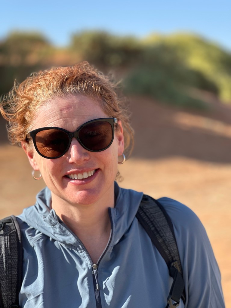
Happy July 4 for those who celebrate it!
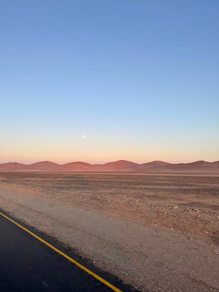
A big day in the desert today. We were up early and on the truck to get to Dune 45 in the dune belt. We were treated to seeing the moon set over the dunes as the sun rose behind us, creating some wonderful conditions colours and shadows in the early morning light.
According to our guide the Namib-Nakluft National Park is the largest in the world- covering roughly a gazillionty million square kilometres. Or something like that. The part we were in today was really deserty desert – absolutely bone dry. In fact the air was so dry many of us developed a cough during the day.
The first task of the morning was a romp up and over Dune 45…. With a few hundred other people. It was like Bourke Street up there folks, with a path along the sand ridge on average one metre wide and a drop of a hundred metres plus down the dune on either side. Dune 45 is approximately 200 metres high at its highest point, the drop off catches your attention.
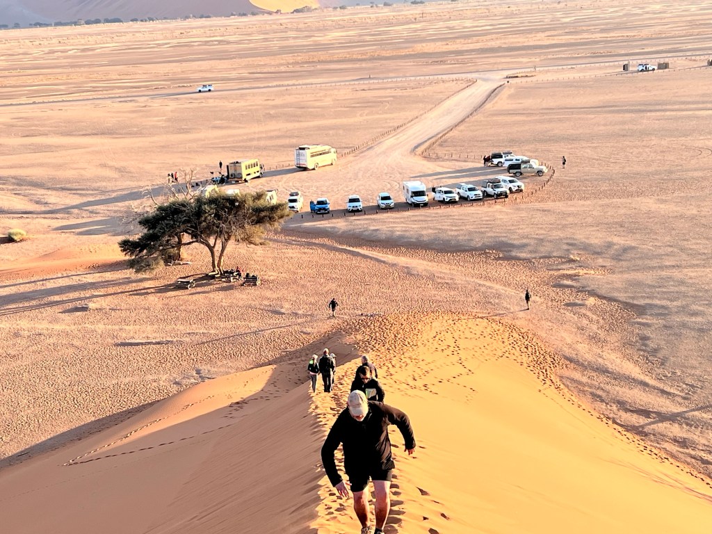
The dune is named because it is 45 kilometres from the main gate. Other dunes are similarly named, except ‘Big Daddy’ near Dryvlei, so named because it is the biggest at between 360 and 380 metres. Apparently the dune heights remain relatively static throughout the year. Another interesting fact – these are the oldest sand dunes in the oldest desert on the world- 200 million years old , give or take a few weeks.
The dunes in the dune fields of the Namib don’t really move much. The reason we were given is because for half the year the predominant wind is an easterly, and it’s westerly for the other half of the year. In a nice piece of symmetry they cancel each other out. Although half way up the first steep ridge of soft sand with burning calves Mark would have been very happy if the wind had blown the entire bastard thing away….
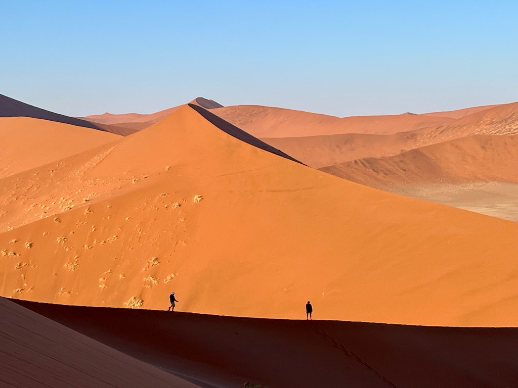
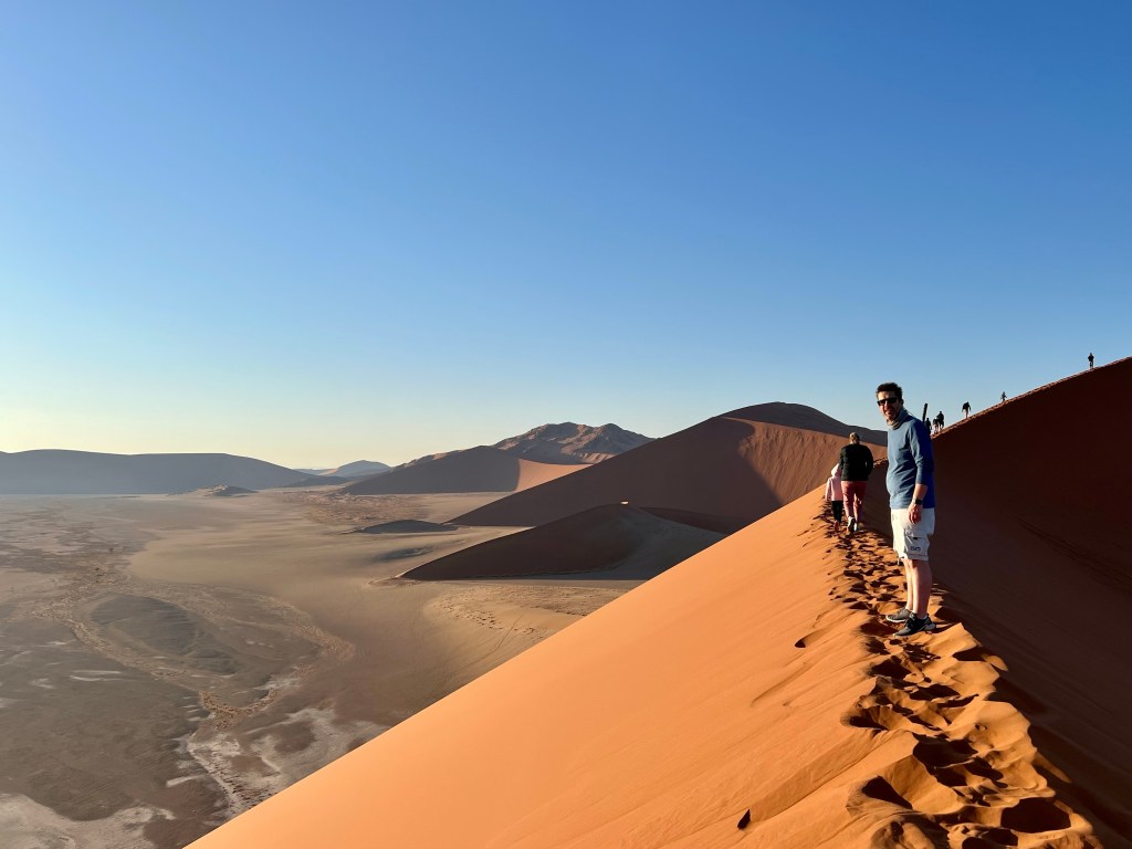
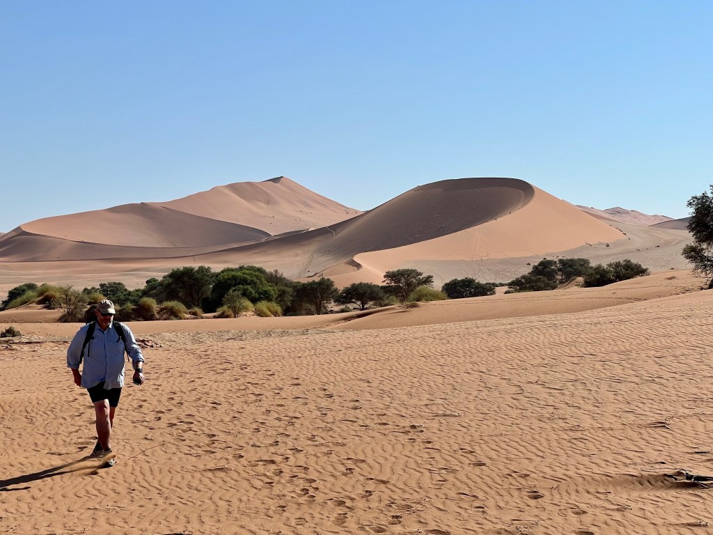
The view from the top over the surrounding dune field was spectacular and worth the effort. The low angle morning sun illuminated the sand in various hues of red, while also casting shadows that clearly delineated and highlighted sharp dune edges and ridge lines.
The trip down was way quicker than that up and along the ridge lines. You literally ‘surf’ off a saddle and down a spur line. From the bottom it’s roughly a one kilometre walk back to the car park. After some water and getting around a kilo of sand out of each shoe it was back on the truck to head for the 4×4 exchange point.
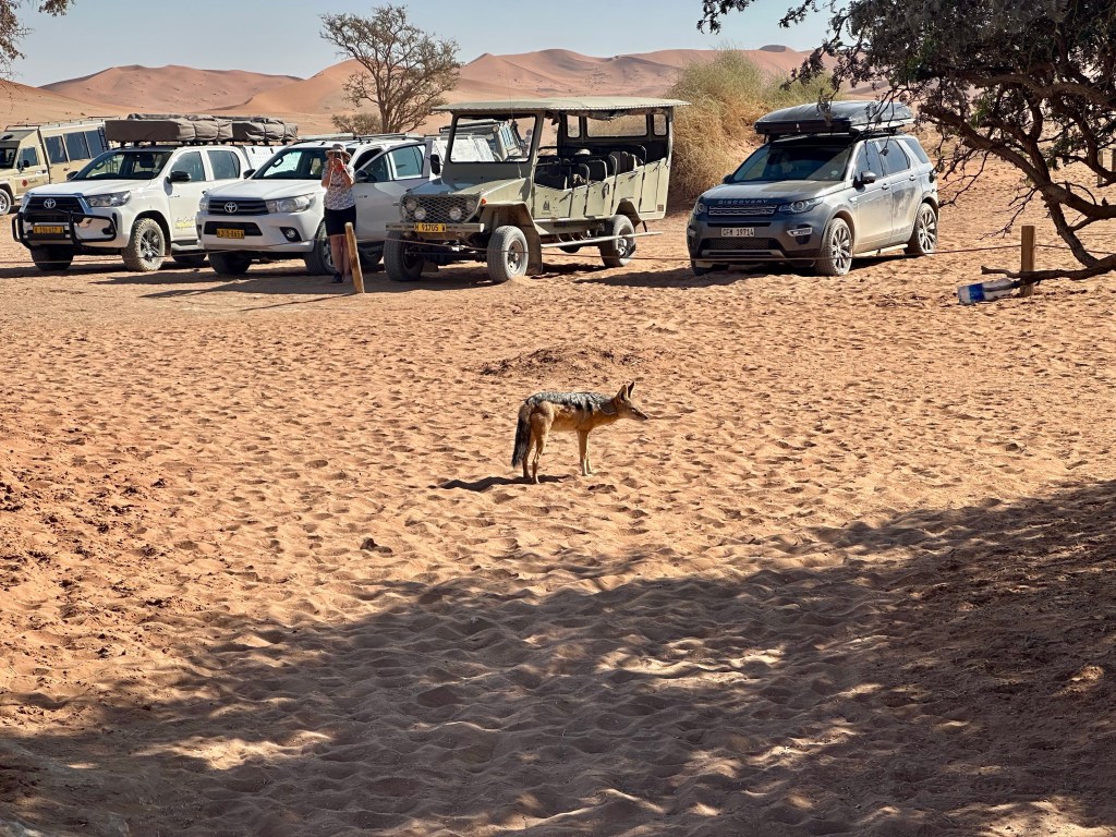
To get deeper into the park tourists who don’t have a small 4wd (eg people on trucks like our tour) have to decant into smaller safari vehicles. This is because the roads are very sandy and trucks , buses and 2wd vehicles quickly get bogged.
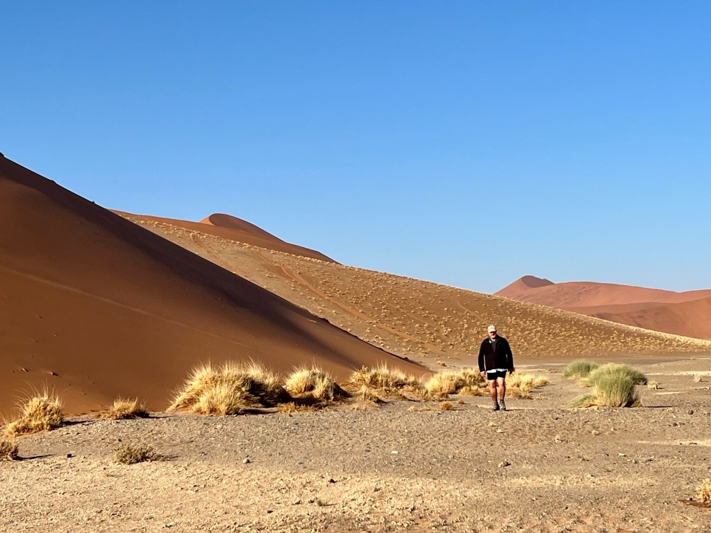
We drove on the Namibia parks 4×4 to the Sossusvlei. This is essentially and ancient dry lake bed which marks the end of one of the local ‘rivers’ (the sand dune belt effectively surrounds it. Once in a blue moon (that is, often many years apart) there is a ‘wet year’ and the Sossusvlei fills up with water for a little while.
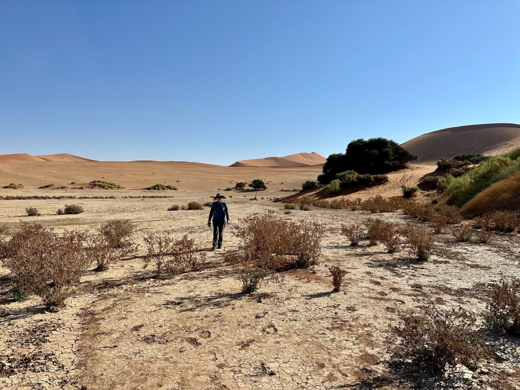
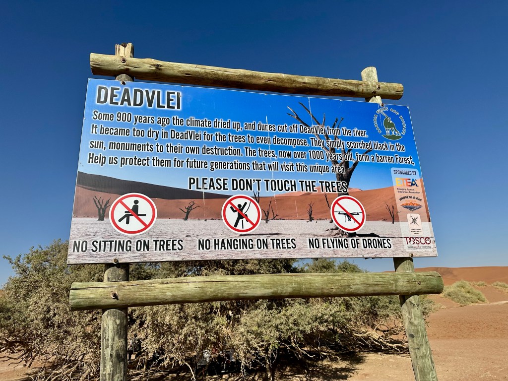
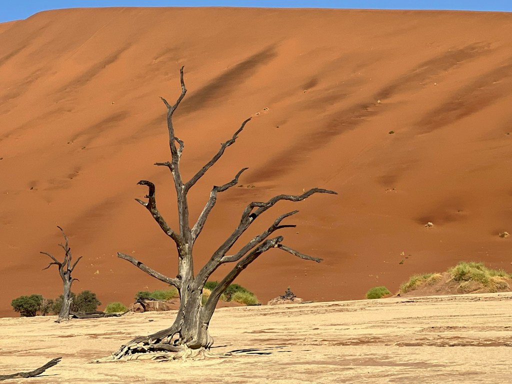
After a walk around the dry Sossusvlei we walked around a kilometre over to the Deadvlei car park. Deadvlei cunningly gets its name from the fact it is a vlei and everything in it is dead. The attached photo explains it, but essentially around 900 to 1,000 years ago the dune fields cut the Deadvlei off from the river feeding Sossusvlei. The trees in the Deadvlei , cut off from water died. They are now preserved, dried out and dead, standing as dark sentinels against the yellow backdrop of the vlei. It was around a 2.5 kilometre return journey up and over loose dune sand in the midday heat.
After lunch at the 4×4 exchange point it was a drive back to the park entrance on a very nice tar road, then 4 kilometres of bone jarring corrugations to Sesrim Canyon.
Sesrim Canyon is where a (usually dry from year to year) river suddenly cuts down around 30 metres. It seems to happen because the underlying strata switches from a hard metamorphic rock to conglomerate. Over the millennia the occasional flood in the otherwise dry river has cut the canyon down through the conglomerate. The canyon itself runs for about 8 kilometres before emptying out the river into the dune fields. Mark surveyed the canyon from the rim while Nessie and the others went down into the canyon as his dodgy right knee was playing up from the morning’s sand dune shenanigans.

After Sesriem Canyon it was back to camp for a lap of the icy pool and a pint of icy Namibian draught beer 🍺 .
